
Cycling in Bleadon
Discover a map of 34 cycling routes and bike trails near Bleadon, created by our community.
Region portrait
Get to know Bleadon
Find the right bike route for you through Bleadon, where we've got 34 cycle routes to explore. Most people get on their bikes to ride here in the month of August.
1,150 km
Tracked distance
34
Cycle routes
Community
Most active users in Bleadon

From our community
The best bike routes in and around Bleadon


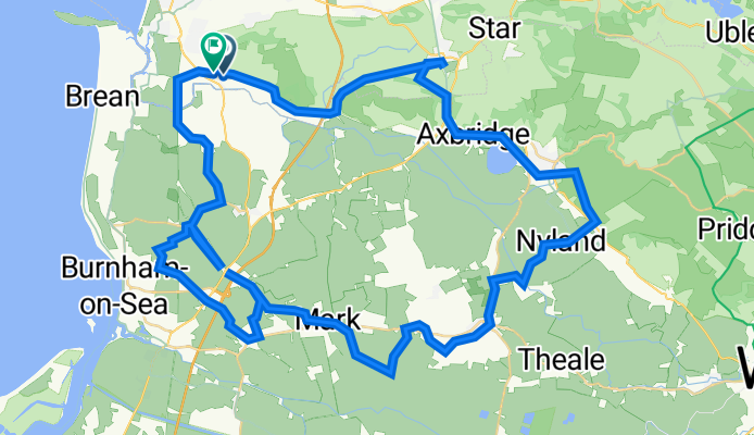
Short bike tour through Axbridge
Cycling route in Bleadon, England, United Kingdom
- 9.9 km
- Distance
- 173 m
- Ascent
- 175 m
- Descent
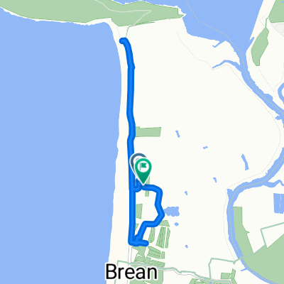
Coronation Road 14, Bleadon to Pine Lea 1, Bleadon
Cycling route in Bleadon, England, United Kingdom
- 65.1 km
- Distance
- 300 m
- Ascent
- 301 m
- Descent

Discover more routes
 LEJOG 2
- Distance
- 286.9 km
- Ascent
- 878 m
- Descent
- 814 m
- Location
- Bleadon, England, United Kingdom
 STEART GRAVEL
- Distance
- 43 km
- Ascent
- 101 m
- Descent
- 103 m
- Location
- Bleadon, England, United Kingdom
 Hillgrove Terrace 4 to Hurn Lane
- Distance
- 14.4 km
- Ascent
- 70 m
- Descent
- 68 m
- Location
- Bleadon, England, United Kingdom
 Warren Road to Warren Road
- Distance
- 5.7 km
- Ascent
- 3 m
- Descent
- 64 m
- Location
- Bleadon, England, United Kingdom
 Weston Super Mare
- Distance
- 21.6 km
- Ascent
- 8 m
- Descent
- 6 m
- Location
- Bleadon, England, United Kingdom
 Weston to Castle Locking
- Distance
- 19.3 km
- Ascent
- 11 m
- Descent
- 60 m
- Location
- Bleadon, England, United Kingdom
 Levels N to S
- Distance
- 34.3 km
- Ascent
- 52 m
- Descent
- 54 m
- Location
- Bleadon, England, United Kingdom
 Old Wall, Weston-super-Mare to 23 Cranwell Road, Weston-super-Mare
- Distance
- 11.1 km
- Ascent
- 6 m
- Descent
- 10 m
- Location
- Bleadon, England, United Kingdom