
Cycling in Aberfeldy
Discover a map of 77 cycling routes and bike trails near Aberfeldy, created by our community.
Region portrait
Get to know Aberfeldy
Find the right bike route for you through Aberfeldy, where we've got 77 cycle routes to explore. Most people get on their bikes to ride here in the months of May and August.
4,932 km
Tracked distance
77
Cycle routes
1,937
Population
Community
Most active users in Aberfeldy


From our community
The best bike routes in and around Aberfeldy

Amulree To Perth II
Cycling route in Aberfeldy, Scotland, United Kingdom
- 34.1 km
- Distance
- 137 m
- Ascent
- 400 m
- Descent

Aberfeldy to Aberfoyle
Cycling route in Aberfeldy, Scotland, United Kingdom
- 90 km
- Distance
- 794 m
- Ascent
- 848 m
- Descent

River Tay Way (sustrans.org.uk)
Cycling route in Aberfeldy, Scotland, United Kingdom
The River Tay Way is a great ride through some of the finest countryside that Perthshire has to offer. Following the path of the mighty River Tay, Scotland’s longest river, this 65 mile/105 km route passes through the communities of Kenmore, Aberfeldy, Dunkeld and Birnam, and the cities of Perth and Dundee. It connects thousands of years of Scottish history by linking the Scottish Crannog Centre at Kenmore and its replica Iron Age crannog, with the V&A Dundee which opened in 2018.
https://www.visitscotland.com/things-to-do/outdoor-activities/cycling/sustrans-map#/river-tay-way
https://www.sustrans.org.uk/
- 110.5 km
- Distance
- 979 m
- Ascent
- 1,091 m
- Descent
coast to coast
Cycling route in Aberfeldy, Scotland, United Kingdom
Von Schottlands Ostküste zur Westküste
Wanderweg
Startpunkt: Perth
Ziel: Fort William
- 160.3 km
- Distance
- 366 m
- Ascent
- 347 m
- Descent
Discover more routes
 Highland Glens and Lowland Hills
- Distance
- 67.9 km
- Ascent
- 593 m
- Descent
- 567 m
- Location
- Aberfeldy, Scotland, United Kingdom
 Schottland Tag 3
- Distance
- 71 km
- Ascent
- 520 m
- Descent
- 503 m
- Location
- Aberfeldy, Scotland, United Kingdom
 2. Tag
- Distance
- 77.8 km
- Ascent
- 873 m
- Descent
- 560 m
- Location
- Aberfeldy, Scotland, United Kingdom
 Crieff Road, Aberfeldy to Urlar Road, Aberfeldy
- Distance
- 26.7 km
- Ascent
- 758 m
- Descent
- 710 m
- Location
- Aberfeldy, Scotland, United Kingdom
 Glen Tay
- Distance
- 136.9 km
- Ascent
- 1,917 m
- Descent
- 1,483 m
- Location
- Aberfeldy, Scotland, United Kingdom
 Crieff Road, Aberfeldy to B8019, Pitlochry
- Distance
- 21.7 km
- Ascent
- 331 m
- Descent
- 282 m
- Location
- Aberfeldy, Scotland, United Kingdom
 Loch Tay & Kenmore Hill
- Distance
- 101.5 km
- Ascent
- 1,439 m
- Descent
- 1,433 m
- Location
- Aberfeldy, Scotland, United Kingdom
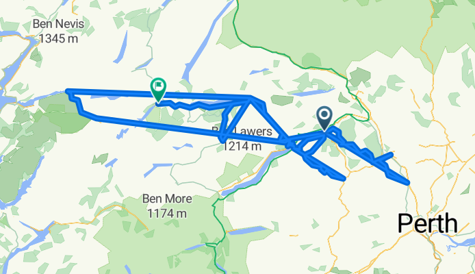
 Amulree/Ben Lawers
- Distance
- 114.7 km
- Ascent
- 1,280 m
- Descent
- 1,310 m
- Location
- Aberfeldy, Scotland, United Kingdom