Cycling in Oensingen
Discover a map of 178 cycling routes and bike trails near Oensingen, created by our community.
Region portrait
Get to know Oensingen
Find the right bike route for you through Oensingen, where we've got 178 cycle routes to explore. Most people get on their bikes to ride here in the months of May and June.
8,220 km
Tracked distance
178
Cycle routes
4,609
Population
Community
Most active users in Oensingen
From our community
The best bike routes in and around Oensingen
Schelten und Chasseral
Cycling route in Oensingen, Canton of Solothurn, Switzerland
- 163.8 km
- Distance
- 1,999 m
- Ascent
- 2,000 m
- Descent
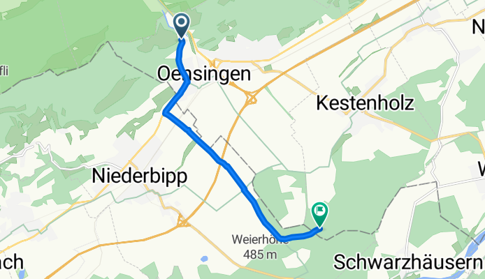
Von Oensingen bis Kestenholz
Cycling route in Oensingen, Canton of Solothurn, Switzerland
- 6.6 km
- Distance
- 60 m
- Ascent
- 60 m
- Descent
Von Oensingen bis Kestenholz
Cycling route in Oensingen, Canton of Solothurn, Switzerland
- 6.7 km
- Distance
- 59 m
- Ascent
- 60 m
- Descent
Sur la Scheulte
Cycling route in Oensingen, Canton of Solothurn, Switzerland
- 44.9 km
- Distance
- 1,711 m
- Ascent
- 883 m
- Descent
Discover more routes
 Scheltenpass-Passwang Plus
- Distance
- 115.4 km
- Ascent
- 1,884 m
- Descent
- 1,858 m
- Location
- Oensingen, Canton of Solothurn, Switzerland
 Gigathlon 2012
- Distance
- 103.7 km
- Ascent
- 1,597 m
- Descent
- 1,661 m
- Location
- Oensingen, Canton of Solothurn, Switzerland
 Roggen
- Distance
- 39.9 km
- Ascent
- 1,193 m
- Descent
- 1,271 m
- Location
- Oensingen, Canton of Solothurn, Switzerland
 Gigathlon 2012 - Rennvelostrecke Samstag
- Distance
- 101.4 km
- Ascent
- 1,501 m
- Descent
- 1,588 m
- Location
- Oensingen, Canton of Solothurn, Switzerland
 Jurasüdfuss up'n'down
- Distance
- 51.3 km
- Ascent
- 1,803 m
- Descent
- 1,879 m
- Location
- Oensingen, Canton of Solothurn, Switzerland
 Oensingen via Wolfisberg,Rumisberg, Oberbipp, Niederbipp retour zu Oensingen
- Distance
- 14.3 km
- Ascent
- 294 m
- Descent
- 295 m
- Location
- Oensingen, Canton of Solothurn, Switzerland
 Tag1 Oensingen-Schluchsee
- Distance
- 111.2 km
- Ascent
- 879 m
- Descent
- 340 m
- Location
- Oensingen, Canton of Solothurn, Switzerland
 Oensingen Allerheiligenberg
- Distance
- 37.6 km
- Ascent
- 817 m
- Descent
- 814 m
- Location
- Oensingen, Canton of Solothurn, Switzerland


