
Cycling in Sandviken
Discover a map of 16 cycling routes and bike trails near Sandviken, created by our community.
Region portrait
Get to know Sandviken
Find the right bike route for you through Sandviken, where we've got 16 cycle routes to explore.
615 km
Tracked distance
16
Cycle routes
22,111
Population
Community
Most active users in Sandviken


From our community
The best bike routes in and around Sandviken


Järnriket - Sandviken med omnejd
Cycling route in Sandviken, Gävleborg County, Sweden
- 19.5 km
- Distance
- 28 m
- Ascent
- 28 m
- Descent

Järnriket - yxigt, javisst!
Cycling route in Sandviken, Gävleborg County, Sweden
- 16.3 km
- Distance
- 48 m
- Ascent
- 48 m
- Descent

Järnriket - Högbo - Oslättfors - Tolvfors
Cycling route in Sandviken, Gävleborg County, Sweden
- 39.1 km
- Distance
- 39 m
- Ascent
- 95 m
- Descent
Discover more routes
 Högbo bruk MTB 20km
- Distance
- 19.8 km
- Ascent
- 59 m
- Descent
- 58 m
- Location
- Sandviken, Gävleborg County, Sweden

Garmin
Sandviken Cycling- Distance
- 32.2 km
- Ascent
- 123 m
- Descent
- 114 m
- Location
- Sandviken, Gävleborg County, Sweden
 Sandviken to Stora Esplanadgatan 23–25a, Gävle
- Distance
- 26 km
- Ascent
- 47 m
- Descent
- 104 m
- Location
- Sandviken, Gävleborg County, Sweden
 boviksrundan
- Distance
- 32.1 km
- Ascent
- 82 m
- Descent
- 85 m
- Location
- Sandviken, Gävleborg County, Sweden
 Dalarna dag 1
- Distance
- 95.6 km
- Ascent
- 418 m
- Descent
- 347 m
- Location
- Sandviken, Gävleborg County, Sweden
 Blixtrundan rek
- Distance
- 1.2 km
- Ascent
- 8 m
- Descent
- 8 m
- Location
- Sandviken, Gävleborg County, Sweden
 Stånggångsvägen to Stånggångsvägen
- Distance
- 1.2 km
- Ascent
- 14 m
- Descent
- 14 m
- Location
- Sandviken, Gävleborg County, Sweden
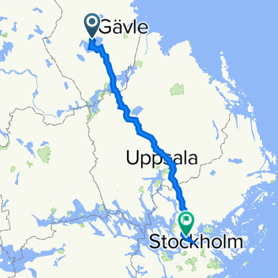 Tulegatan 23C, Sandviken to Flygplatsinfarten 39, Stockholm
- Distance
- 192.3 km
- Ascent
- 912 m
- Descent
- 971 m
- Location
- Sandviken, Gävleborg County, Sweden