
Cycling in Åmotfors
Discover a map of 12 cycling routes and bike trails near Åmotfors, created by our community.
Region portrait
Get to know Åmotfors
Find the right bike route for you through Åmotfors, where we've got 12 cycle routes to explore.
1,035 km
Tracked distance
12
Cycle routes
1,476
Population


Handpicked routes
Discover Åmotfors through these collections
Tour
From our community
The best bike routes in and around Åmotfors

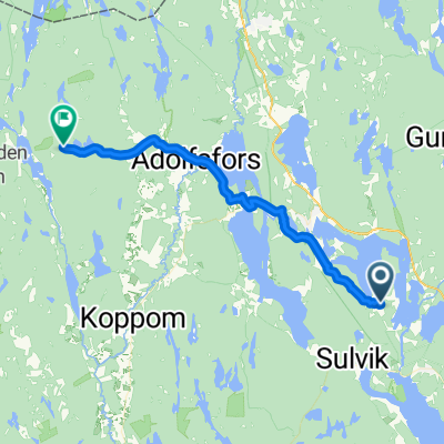
Arboten (SVE)-Magnor (NOR)
Cycling route in Åmotfors, Värmland County, Sweden
- 39.3 km
- Distance
- 365 m
- Ascent
- 360 m
- Descent

Ånnebol - Akkers brygga
Cycling route in Åmotfors, Värmland County, Sweden
- 122.4 km
- Distance
- 600 m
- Ascent
- 725 m
- Descent

dzień jedenasty
Cycling route in Åmotfors, Värmland County, Sweden
- 104 km
- Distance
- 406 m
- Ascent
- 376 m
- Descent

Värmland Pausentag
Cycling route in Åmotfors, Värmland County, Sweden
- 6.4 km
- Distance
- 81 m
- Ascent
- 129 m
- Descent
Discover more routes
 31.7.2011
- Distance
- 111.2 km
- Ascent
- 369 m
- Descent
- 416 m
- Location
- Åmotfors, Värmland County, Sweden
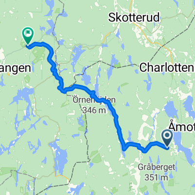
 Åmotfors - Charlottenberg
- Distance
- 30.1 km
- Ascent
- 510 m
- Descent
- 427 m
- Location
- Åmotfors, Värmland County, Sweden
 De Väg Utan Namn à Fallanveien
- Distance
- 148.8 km
- Ascent
- 2,105 m
- Descent
- 2,006 m
- Location
- Åmotfors, Värmland County, Sweden
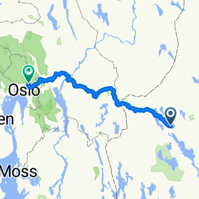
 Åmotfors - Bjørkelangen
- Distance
- 57.8 km
- Ascent
- 982 m
- Descent
- 821 m
- Location
- Åmotfors, Värmland County, Sweden
 Värmland 4. Etappe
- Distance
- 28.4 km
- Ascent
- 218 m
- Descent
- 266 m
- Location
- Åmotfors, Värmland County, Sweden
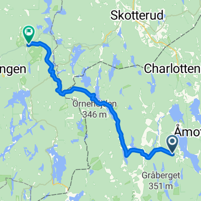 Åmotfors - Bjørkelangen
- Distance
- 56.5 km
- Ascent
- 970 m
- Descent
- 771 m
- Location
- Åmotfors, Värmland County, Sweden
 Järvens väg 11, Gunnarskog to Gustaf Adolfs torg 1, Göteborg
- Distance
- 300.4 km
- Ascent
- 2,625 m
- Descent
- 2,715 m
- Location
- Åmotfors, Värmland County, Sweden
- Stora Årbotten Haget, Gunnarskog to Eda, Charlottenberg
- Distance
- 30.1 km
- Ascent
- 389 m
- Descent
- 395 m
- Location
- Åmotfors, Värmland County, Sweden