
Cycling in Röthelstein
Discover a map of 67 cycling routes and bike trails near Röthelstein, created by our community.
Region portrait
Get to know Röthelstein
Find the right bike route for you through Röthelstein, where we've got 67 cycle routes to explore. Most people get on their bikes to ride here in the month of July.
3,350 km
Tracked distance
67
Cycle routes
Community
Most active users in Röthelstein


From our community
The best bike routes in and around Röthelstein

017 Drachentour
Cycling route in Röthelstein, Styria, Austria
- 40.8 km
- Distance
- 1,184 m
- Ascent
- 1,184 m
- Descent


Discover more routes
 Bärenschützklamm + Hochlantsch
- Distance
- 22.4 km
- Ascent
- 1,301 m
- Descent
- 1,301 m
- Location
- Röthelstein, Styria, Austria
 Teichalmrunde Steiermark
- Distance
- 16.8 km
- Ascent
- 654 m
- Descent
- 672 m
- Location
- Röthelstein, Styria, Austria
 Drachentour (neu)
- Distance
- 41.9 km
- Ascent
- 1,198 m
- Descent
- 1,198 m
- Location
- Röthelstein, Styria, Austria
 Route nach Teichalm 42a
- Distance
- 82.8 km
- Ascent
- 8,567 m
- Descent
- 8,565 m
- Location
- Röthelstein, Styria, Austria
 teichalm tour
- Distance
- 38.5 km
- Ascent
- 1,124 m
- Descent
- 1,121 m
- Location
- Röthelstein, Styria, Austria
 Raabtalradweg
- Distance
- 96.7 km
- Ascent
- 1,075 m
- Descent
- 2,009 m
- Location
- Röthelstein, Styria, Austria
 Graz-Teich
- Distance
- 43.8 km
- Ascent
- 100 m
- Descent
- 175 m
- Location
- Röthelstein, Styria, Austria
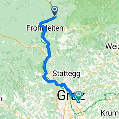
 Teichalm -> Stattegg
- Distance
- 34.3 km
- Ascent
- 562 m
- Descent
- 1,333 m
- Location
- Röthelstein, Styria, Austria