
Cycling in Wittgendorf
Discover a map of 15 cycling routes and bike trails near Wittgendorf, created by our community.
Region portrait
Get to know Wittgendorf
Find the right bike route for you through Wittgendorf, where we've got 15 cycle routes to explore.
563 km
Tracked distance
15
Cycle routes
216
Population
Community
Most active users in Wittgendorf

From our community
The best bike routes in and around Wittgendorf

2014-07-20 Hoheneiche-Rohrbach-Doschnitz-Aumühle-Volkmannsdorf-Wickersdorf
Cycling route in Wittgendorf, Thuringia, Germany
lange Bergabfahrten und ebenso lange Anstiege
- 21.2 km
- Distance
- 504 m
- Ascent
- 503 m
- Descent

2014-07-23 Hoheneiche-Grafenthal-Piesau-Lichte-LeipzigerTurm
Cycling route in Wittgendorf, Thuringia, Germany
ständiges bergauf und bergab, aber geil !!!
- 51.7 km
- Distance
- 1,185 m
- Ascent
- 1,182 m
- Descent

2014-07-21 Hoheneiche-Rundweg Talsperre Leibnis / Lichte
Cycling route in Wittgendorf, Thuringia, Germany
wunderbare Aussichten ins Thüringer Land
- 39.2 km
- Distance
- 698 m
- Ascent
- 695 m
- Descent

2014-07-22 Hoheneiche-Unterloquitz-LohmTurm-Saalfeld-Eyba
Cycling route in Wittgendorf, Thuringia, Germany
angenehme Runde mit zwei steilen Anstiegen
- 45 km
- Distance
- 1,112 m
- Ascent
- 1,112 m
- Descent
Discover more routes
 Wickersdorf-Schwarzatal-Saalfeld
- Distance
- 32.8 km
- Ascent
- 275 m
- Descent
- 680 m
- Location
- Wittgendorf, Thuringia, Germany
 Hoheneiche-Reichmannsdorf-Hoheneiche
- Distance
- 11.7 km
- Ascent
- 223 m
- Descent
- 223 m
- Location
- Wittgendorf, Thuringia, Germany
 Moderate Route
- Distance
- 16.9 km
- Ascent
- 332 m
- Descent
- 349 m
- Location
- Wittgendorf, Thuringia, Germany
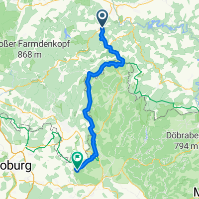 Tag 4.2 Arnsgereuth nach Mitwitz
- Distance
- 67 km
- Ascent
- 3,119 m
- Descent
- 3,467 m
- Location
- Wittgendorf, Thuringia, Germany
 Wickersdorf - Arnstadt
- Distance
- 55.8 km
- Ascent
- 380 m
- Descent
- 745 m
- Location
- Wittgendorf, Thuringia, Germany
 Spaziergang Wittkendorf
- Distance
- 0.2 km
- Ascent
- 7 m
- Descent
- 12 m
- Location
- Wittgendorf, Thuringia, Germany
 HohenEiche Saalfeld
- Distance
- 13.8 km
- Ascent
- 65 m
- Descent
- 509 m
- Location
- Wittgendorf, Thuringia, Germany
 Am Goldberg 1, Saalfeld/Saale nach Winzergasse 7, Jena
- Distance
- 91.6 km
- Ascent
- 9,851 m
- Descent
- 10,248 m
- Location
- Wittgendorf, Thuringia, Germany