
Cycling in Ranis
Discover a map of 15 cycling routes and bike trails near Ranis, created by our community.
Region portrait
Get to know Ranis
Find the right bike route for you through Ranis, where we've got 15 cycle routes to explore.
748 km
Tracked distance
15
Cycle routes
2,006
Population
Community
Most active users in Ranis


From our community
The best bike routes in and around Ranis

Ranis-Saalfeld-Ranis
Cycling route in Ranis, Free State of Thuringia, Germany
Schöne Rundtour mit gutem Blick vom Roten Berg zurück auf Saalfeld und vorher auf angenehmen Radwegen oder wenig befahrenen Straßen nach Saalfeld.
- 34.4 km
- Distance
- 380 m
- Ascent
- 366 m
- Descent

L2367 2, Ranis nach L2367 2, Ranis
Cycling route in Ranis, Free State of Thuringia, Germany
- 37.2 km
- Distance
- 1,596 m
- Ascent
- 1,596 m
- Descent
??^‰? nach ??^‰?
Cycling route in Ranis, Free State of Thuringia, Germany
- 20 km
- Distance
- 100 m
- Ascent
- 240 m
- Descent

Route von Planstraße 12, Ranis
Cycling route in Ranis, Free State of Thuringia, Germany
- 12.6 km
- Distance
- 210 m
- Ascent
- 273 m
- Descent
Discover more routes
 Bahnhofstraße 17, Ranis nach Am Stauseeblick 1, Hohenwarte
- Distance
- 10 km
- Ascent
- 357 m
- Descent
- 325 m
- Location
- Ranis, Free State of Thuringia, Germany
 Am Burgparkplatz 2, Ranis nach Brandenstein 1, Ranis
- Distance
- 1.2 km
- Ascent
- 37 m
- Descent
- 74 m
- Location
- Ranis, Free State of Thuringia, Germany
 Blumenstraße 40, Ranis nach Blumenstraße 40, Ranis
- Distance
- 15.2 km
- Ascent
- 233 m
- Descent
- 234 m
- Location
- Ranis, Free State of Thuringia, Germany
 Am Wald, Ranis nach Ortsstraße 1, Seisla
- Distance
- 4.3 km
- Ascent
- 41 m
- Descent
- 102 m
- Location
- Ranis, Free State of Thuringia, Germany
 Route von Blumenstraße 41, Ranis
- Distance
- 41.9 km
- Ascent
- 419 m
- Descent
- 455 m
- Location
- Ranis, Free State of Thuringia, Germany
 Blumenstraße 41, Ranis nach Planstraße 13, Ranis
- Distance
- 16.9 km
- Ascent
- 633 m
- Descent
- 634 m
- Location
- Ranis, Free State of Thuringia, Germany
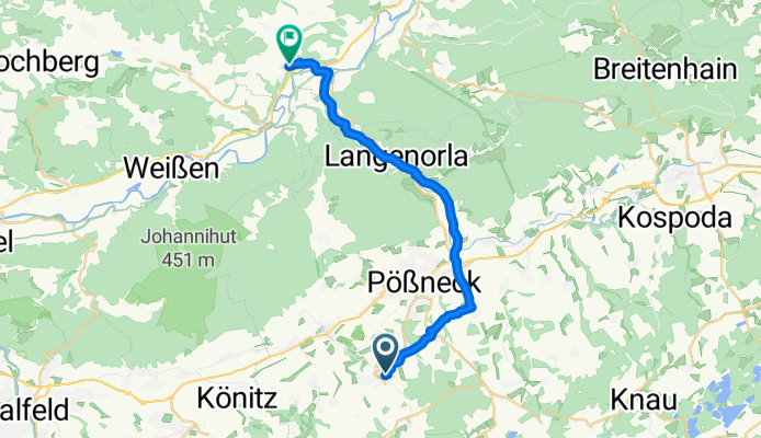
 Planstraße 11, Ranis nach Mittelweg, Pößneck
- Distance
- 9.3 km
- Ascent
- 41 m
- Descent
- 197 m
- Location
- Ranis, Free State of Thuringia, Germany
 Rathausstraße 6, Ranis nach Friedebacher Straße 45, Krölpa
- Distance
- 5.2 km
- Ascent
- 78 m
- Descent
- 181 m
- Location
- Ranis, Free State of Thuringia, Germany