
Cycling in Langenwetzendorf
Discover a map of 25 cycling routes and bike trails near Langenwetzendorf, created by our community.
Region portrait
Get to know Langenwetzendorf
Find the right bike route for you through Langenwetzendorf, where we've got 25 cycle routes to explore.
1,664 km
Tracked distance
25
Cycle routes
3,774
Population
Community
Most active users in Langenwetzendorf


From our community
The best bike routes in and around Langenwetzendorf

Klingenthaler Runde
Cycling route in Langenwetzendorf, Thuringia, Germany
- 127.2 km
- Distance
- 1,061 m
- Ascent
- 1,057 m
- Descent

Rund ums Elstertal
Cycling route in Langenwetzendorf, Thuringia, Germany
- 29.9 km
- Distance
- 441 m
- Ascent
- 438 m
- Descent

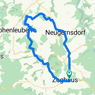
NAI TALSPERRE ZR NAI
Cycling route in Langenwetzendorf, Thuringia, Germany
Naitschau - um die Talsperre Zeulenroda - Naitschau
- 48.5 km
- Distance
- 333 m
- Ascent
- 334 m
- Descent

Neustädter Runde
Cycling route in Langenwetzendorf, Thuringia, Germany
Schöne Runde mit zweifacher Passage der Zeulenrodaer Talsperre, anfangs offenes z.T. windanfälliges Gelände, hinter Neustadt gehts dann in den Wald und nach dem Abzweig Tröbnitz durch ein sanftes Tal Richtung A9 (gutes Zeitfahrtrainingsterrain), Gelände bietet mäßige Anstiege mit zwei, drei kleinen Rampen (z.B. von Wöhlsdorf nach Piesigitz). Wer sich noch ordentlich die kante geben will, biegt in Wöhlsdorf links ab Richtung Staitz, dann weiter Richtung Triebes über den Dörtendorfer "Hanka-Berg" - der wird alljährlich zur Thüringen-Rundfahrt der Damen strapaziert). Ist aber für jeden guttrainierten Radler kein Problem. Tipp:
danach noch auf ein isotonisches Kaltgetränk in den Biergarten vom Seehotel Zeulenroda. Zufahrt über Abzweig Waikiki, hinder dem Bauerfeind-Tower. Fahrzeit ca. 3,5h
- 103 km
- Distance
- 804 m
- Ascent
- 802 m
- Descent
Discover more routes
 Männertag II
- Distance
- 70 km
- Ascent
- 240 m
- Descent
- 475 m
- Location
- Langenwetzendorf, Thuringia, Germany
 Pfingsten
- Distance
- 23.1 km
- Ascent
- 274 m
- Descent
- 277 m
- Location
- Langenwetzendorf, Thuringia, Germany
 Hohenwarte ab Moschwitz
- Distance
- 132.4 km
- Ascent
- 1,060 m
- Descent
- 1,092 m
- Location
- Langenwetzendorf, Thuringia, Germany
 Von Nai nach Weißenfels
- Distance
- 78.5 km
- Ascent
- 255 m
- Descent
- 469 m
- Location
- Langenwetzendorf, Thuringia, Germany
 Zeule
Zeule- Distance
- 38.5 km
- Ascent
- 412 m
- Descent
- 418 m
- Location
- Langenwetzendorf, Thuringia, Germany
 Elsterradweg von Naitschau aus
- Distance
- 148 km
- Ascent
- 229 m
- Descent
- 514 m
- Location
- Langenwetzendorf, Thuringia, Germany
 Kleine Kirchberger Runde
- Distance
- 132.7 km
- Ascent
- 1,101 m
- Descent
- 1,101 m
- Location
- Langenwetzendorf, Thuringia, Germany
 Langenwetzendorf - Wünschendorf
- Distance
- 17.1 km
- Ascent
- 195 m
- Descent
- 318 m
- Location
- Langenwetzendorf, Thuringia, Germany