
Cycling in Königsee
Discover a map of 34 cycling routes and bike trails near Königsee, created by our community.
Region portrait
Get to know Königsee
Find the right bike route for you through Königsee, where we've got 34 cycle routes to explore. Most people get on their bikes to ride here in the month of August.
1,849 km
Tracked distance
34
Cycle routes
5,666
Population


From our community
The best bike routes in and around Königsee


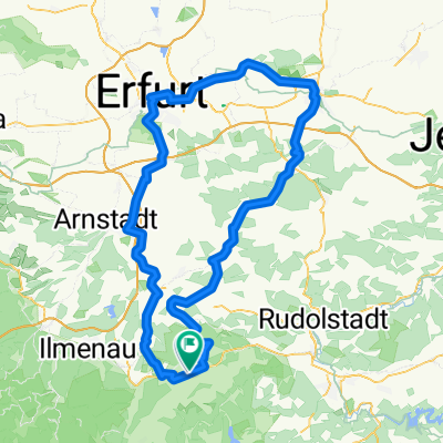
Königsee - Paulinzella
Cycling route in Königsee, Thuringia, Germany
- 20.9 km
- Distance
- 347 m
- Ascent
- 347 m
- Descent

Königsee - Lichta - Käsemarkt - Unterhain
Cycling route in Königsee, Thuringia, Germany
- 6.3 km
- Distance
- 273 m
- Ascent
- 119 m
- Descent

Discover more routes
 Klosterroute
- Distance
- 47.3 km
- Ascent
- 391 m
- Descent
- 391 m
- Location
- Königsee, Thuringia, Germany
 Königsee Löwen-Trail (S1-S2)
- Distance
- 1.1 km
- Ascent
- 8 m
- Descent
- 107 m
- Location
- Königsee, Thuringia, Germany
 Franks Nachmittagstour
- Distance
- 25.7 km
- Ascent
- 524 m
- Descent
- 524 m
- Location
- Königsee, Thuringia, Germany
 Rundfahrt 15 Jahre EG Rottenbach
- Distance
- 27.8 km
- Ascent
- 330 m
- Descent
- 245 m
- Location
- Königsee, Thuringia, Germany
 Route im Schneckentempo in Bad Blankenburg
- Distance
- 15.3 km
- Ascent
- 12 m
- Descent
- 128 m
- Location
- Königsee, Thuringia, Germany
 Moderate Route in Gehren
- Distance
- 11.3 km
- Ascent
- 217 m
- Descent
- 31 m
- Location
- Königsee, Thuringia, Germany
 Quer durch Süd-Thüringen_2
- Distance
- 51.2 km
- Ascent
- 1,235 m
- Descent
- 970 m
- Location
- Königsee, Thuringia, Germany
 Route in Königsee
- Distance
- 133.9 km
- Ascent
- 1,419 m
- Descent
- 1,419 m
- Location
- Königsee, Thuringia, Germany