
Cycling in Kirchheim
Discover a map of 17 cycling routes and bike trails near Kirchheim, created by our community.
Region portrait
Get to know Kirchheim
Find the right bike route for you through Kirchheim, where we've got 17 cycle routes to explore.
675 km
Tracked distance
17
Cycle routes
1,219
Population
Community
Most active users in Kirchheim


From our community
The best bike routes in and around Kirchheim

Ilm-Tour
Cycling route in Kirchheim, Thuringia, Germany
Vorbei am Stausee
- 47.8 km
- Distance
- 395 m
- Ascent
- 385 m
- Descent

Kirchheim-Erfurter Zoopark-Kirchheim
Cycling route in Kirchheim, Thuringia, Germany
- 84.8 km
- Distance
- 327 m
- Ascent
- 283 m
- Descent

Kirchheim - Neuhaus am Rennweg
Cycling route in Kirchheim, Thuringia, Germany
67 km lang, durch den Thüringer Wald
- 64.6 km
- Distance
- 975 m
- Ascent
- 425 m
- Descent

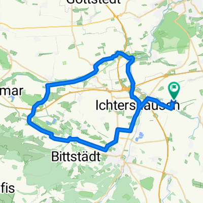
Kirchweg 18, Kirchheim nach Kirchweg 19, Kirchheim
Cycling route in Kirchheim, Thuringia, Germany
- 15.6 km
- Distance
- 99 m
- Ascent
- 101 m
- Descent
Discover more routes
 Mit der Apple Watch um 30. Juli, 18:33 aufgenommen
- Distance
- 44.9 km
- Ascent
- 254 m
- Descent
- 254 m
- Location
- Kirchheim, Thuringia, Germany
 Kirchweg 19, Kirchheim nach Kirchweg 19, Kirchheim
- Distance
- 61.2 km
- Ascent
- 881 m
- Descent
- 882 m
- Location
- Kirchheim, Thuringia, Germany
 Arnstädter Straße 50, Amt Wachsenburg nach Gera-Radweg, Geratal
- Distance
- 25.6 km
- Ascent
- 265 m
- Descent
- 59 m
- Location
- Kirchheim, Thuringia, Germany
 Ahornweg 21, Kirchheim nach Am Anthügel 17, Wachsenburggemeinde
- Distance
- 14.4 km
- Ascent
- 73 m
- Descent
- 41 m
- Location
- Kirchheim, Thuringia, Germany
 kurze aufwärmrunde
- Distance
- 28.5 km
- Ascent
- 215 m
- Descent
- 214 m
- Location
- Kirchheim, Thuringia, Germany
 Kirchheim-Wechmar-Kirchheim
- Distance
- 52.4 km
- Ascent
- 170 m
- Descent
- 161 m
- Location
- Kirchheim, Thuringia, Germany
 ÄL —? nach ÄL —?
- Distance
- 11.4 km
- Ascent
- 104 m
- Descent
- 106 m
- Location
- Kirchheim, Thuringia, Germany
 Kircheim-Wachsenburg-and return
- Distance
- 42.9 km
- Ascent
- 225 m
- Descent
- 230 m
- Location
- Kirchheim, Thuringia, Germany