
Cycling in Hopfgarten
Discover a map of 114 cycling routes and bike trails near Hopfgarten, created by our community.
Region portrait
Get to know Hopfgarten
Find the right bike route for you through Hopfgarten, where we've got 114 cycle routes to explore. Most people get on their bikes to ride here in the months of June and August.
4,312 km
Tracked distance
114
Cycle routes
696
Population
Community
Most active users in Hopfgarten


Handpicked routes
Discover Hopfgarten through these collections
Tour
From our community
The best bike routes in and around Hopfgarten

Nördlich von Weimar
Cycling route in Hopfgarten, Thuringia, Germany
- 31.2 km
- Distance
- 312 m
- Ascent
- 173 m
- Descent

Rund um Erfurt mit dem MTB
Cycling route in Hopfgarten, Thuringia, Germany
- 90.4 km
- Distance
- 439 m
- Ascent
- 435 m
- Descent

Nordwestlich von Weimar mit Ettersberg
Cycling route in Hopfgarten, Thuringia, Germany
- 30.1 km
- Distance
- 357 m
- Ascent
- 357 m
- Descent

Discover more routes
 MTB Südwestlich von Weimar
- Distance
- 36.8 km
- Ascent
- 432 m
- Descent
- 432 m
- Location
- Hopfgarten, Thuringia, Germany
 Weima Rosslau
- Distance
- 165.3 km
- Ascent
- 557 m
- Descent
- 752 m
- Location
- Hopfgarten, Thuringia, Germany
 Weimar - Halle CLONED FROM ROUTE 332382
- Distance
- 116.5 km
- Ascent
- 136 m
- Descent
- 288 m
- Location
- Hopfgarten, Thuringia, Germany
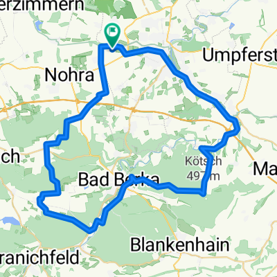
 Weimar - Bad Berka Paulinen Turm Kötsch CLONED FROM ROUTE 1283125
- Distance
- 49 km
- Ascent
- 568 m
- Descent
- 568 m
- Location
- Hopfgarten, Thuringia, Germany
 Gaberndorf-Bad Sulza-Gaberndorf
- Distance
- 70.3 km
- Ascent
- 437 m
- Descent
- 437 m
- Location
- Hopfgarten, Thuringia, Germany
 Rund um Hopfgarten
- Distance
- 12.4 km
- Ascent
- 103 m
- Descent
- 110 m
- Location
- Hopfgarten, Thuringia, Germany
 03042010 MB Training
- Distance
- 50.3 km
- Ascent
- 698 m
- Descent
- 735 m
- Location
- Hopfgarten, Thuringia, Germany
 RR 03062010
- Distance
- 32 km
- Ascent
- 249 m
- Descent
- 245 m
- Location
- Hopfgarten, Thuringia, Germany