
Cycling in Harra
Discover a map of 24 cycling routes and bike trails near Harra, created by our community.
Region portrait
Get to know Harra
Find the right bike route for you through Harra, where we've got 24 cycle routes to explore.
1,443 km
Tracked distance
24
Cycle routes
Community
Most active users in Harra


From our community
The best bike routes in and around Harra
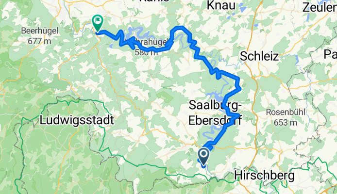
Day 2 Harra - Kaulsdorf
Cycling route in Harra, Thuringia, Germany
- 71.7 km
- Distance
- 1,270 m
- Ascent
- 1,494 m
- Descent


Am Stausee 4, Rosenthal am Rennsteig nach Am Stausee 4, Rosenthal am Rennsteig
Cycling route in Harra, Thuringia, Germany
- 37 km
- Distance
- 207 m
- Ascent
- 346 m
- Descent
Discover more routes
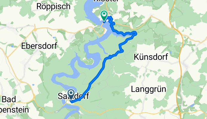
 Saaldorf, Schülerhaltestelle, Bad Lobenstein nach Markt 58, Saalburg-Ebersdorf
- Distance
- 11.6 km
- Ascent
- 192 m
- Descent
- 257 m
- Location
- Harra, Thuringia, Germany
 harra-eichicht
- Distance
- 69.8 km
- Ascent
- 1,334 m
- Descent
- 1,557 m
- Location
- Harra, Thuringia, Germany
 Dienstag - Harra- Saalfeld
- Distance
- 78.2 km
- Ascent
- 1,555 m
- Descent
- 1,772 m
- Location
- Harra, Thuringia, Germany
 2. Etappe von Harra nach Eichicht 70 Km
- Distance
- 70.6 km
- Ascent
- 1,470 m
- Descent
- 1,709 m
- Location
- Harra, Thuringia, Germany
 An der Bent 5, Rosenthal am Rennsteig nach Lorenz-Krapp-Straße 6, Bamberg
- Distance
- 110.8 km
- Ascent
- 762 m
- Descent
- 970 m
- Location
- Harra, Thuringia, Germany
 Schulstraße 8, Rosenthal am Rennsteig nach Schulstraße 10, Rosenthal am Rennsteig
- Distance
- 6.1 km
- Ascent
- 88 m
- Descent
- 98 m
- Location
- Harra, Thuringia, Germany
 Harra Zell
- Distance
- 64.8 km
- Ascent
- 591 m
- Descent
- 420 m
- Location
- Harra, Thuringia, Germany
 Am Stausee 4, Rosenthal am Rennsteig nach L1104, Schmorda
- Distance
- 48.6 km
- Ascent
- 794 m
- Descent
- 714 m
- Location
- Harra, Thuringia, Germany