Cycling in Eisenach
Discover a map of 937 cycling routes and bike trails near Eisenach, created by our community.
Region portrait
Get to know Eisenach
Find the right bike route for you through Eisenach, where we've got 937 cycle routes to explore. Most people get on their bikes to ride here in the months of May and August.
67,720 km
Tracked distance
937
Cycle routes
43,846
Population
Handpicked routes
Discover Eisenach through these collections
Tour
Hercules–Wartburg Cycle Route
6 routes
Tour
From our community
The best bike routes in and around Eisenach
Trailschaukel Eisenach
Cycling route in Eisenach, Thuringia, Germany
- 35.8 km
- Distance
- 923 m
- Ascent
- 923 m
- Descent
Goethestraße, Eisenach nach Planstraße, Amt Creuzburg
Cycling route in Eisenach, Thuringia, Germany
- 26.1 km
- Distance
- 394 m
- Ascent
- 431 m
- Descent
Discover more routes
 Thüringer Radfernwege - 11 - Thüringer Städtekette - D-Route 4
- Distance
- 233.6 km
- Ascent
- 1,500 m
- Descent
- 1,543 m
- Location
- Eisenach, Thuringia, Germany
 Eisenach -Kerspenhausen
- Distance
- 79.7 km
- Ascent
- 537 m
- Descent
- 549 m
- Location
- Eisenach, Thuringia, Germany
 Eisenach und 4 Flüsse
- Distance
- 276.4 km
- Ascent
- 381 m
- Descent
- 380 m
- Location
- Eisenach, Thuringia, Germany
 Rund um den Hainich_t
- Distance
- 116.4 km
- Ascent
- 1,237 m
- Descent
- 1,239 m
- Location
- Eisenach, Thuringia, Germany
 Zentraler Thüringer Wald
- Distance
- 99.9 km
- Ascent
- 1,260 m
- Descent
- 1,260 m
- Location
- Eisenach, Thuringia, Germany
 Westroute Thüringer Wald
- Distance
- 96 km
- Ascent
- 1,150 m
- Descent
- 1,150 m
- Location
- Eisenach, Thuringia, Germany
 12.07.24 Eisenach-Wilhelmglücksbrunn
- Distance
- 34.3 km
- Ascent
- 245 m
- Descent
- 245 m
- Location
- Eisenach, Thuringia, Germany
 07.Wer.Eisen.-Philipst.
- Distance
- 195.8 km
- Ascent
- 2,079 m
- Descent
- 1,479 m
- Location
- Eisenach, Thuringia, Germany
Routes from Eisenach
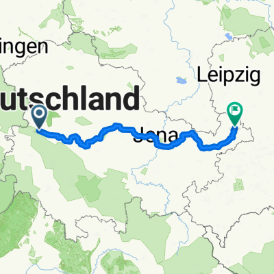
Bikepacking from
Eisenach to Altenburg
Cycling day trip from
Eisenach to Erfurt
Routes to Eisenach
Cycling day trip from
Erfurt to Eisenach


