
Cycling in Drognitz
Discover a map of 20 cycling routes and bike trails near Drognitz, created by our community.
Region portrait
Get to know Drognitz
Find the right bike route for you through Drognitz, where we've got 20 cycle routes to explore.
1,362 km
Tracked distance
20
Cycle routes
712
Population


Handpicked routes
Discover Drognitz through these collections
Tour
From our community
The best bike routes in and around Drognitz
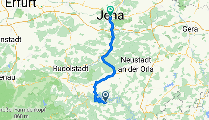
Drognitz - Orlamünde
Cycling route in Drognitz, Thuringia, Germany
- 63.6 km
- Distance
- 611 m
- Ascent
- 992 m
- Descent

Feierabend in der Heimat
Cycling route in Drognitz, Thuringia, Germany
- 9.2 km
- Distance
- 328 m
- Ascent
- 323 m
- Descent

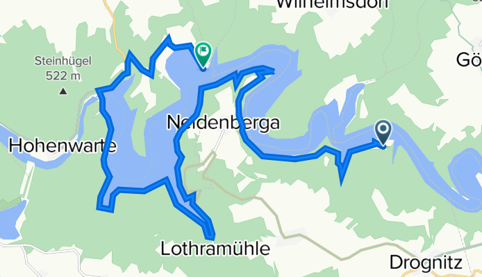
Reitzengeschwenda - Burgk
Cycling route in Drognitz, Thuringia, Germany
- 26 km
- Distance
- 413 m
- Ascent
- 497 m
- Descent
Zeltplatz Hopfenmühle 78, Drognitz nach Saalthal 6, Unterwellenborn
Cycling route in Drognitz, Thuringia, Germany
- 18.8 km
- Distance
- 147 m
- Ascent
- 174 m
- Descent
Discover more routes
 Ortsstraße 62, Drognitz nach Saaldorf 14, Bad Lobenstein
- Distance
- 25.5 km
- Ascent
- 441 m
- Descent
- 511 m
- Location
- Drognitz, Thuringia, Germany
 Saaleradweg
- Distance
- 314.5 km
- Ascent
- 267 m
- Descent
- 721 m
- Location
- Drognitz, Thuringia, Germany
 Rundfahrt
- Distance
- 55.1 km
- Ascent
- 770 m
- Descent
- 770 m
- Location
- Drognitz, Thuringia, Germany
 60er Runde
- Distance
- 60.4 km
- Ascent
- 701 m
- Descent
- 699 m
- Location
- Drognitz, Thuringia, Germany
 Drognitz
- Distance
- 67.7 km
- Ascent
- 470 m
- Descent
- 590 m
- Location
- Drognitz, Thuringia, Germany
 testroute ertsgebergte-saale
- Distance
- 135.1 km
- Ascent
- 1,394 m
- Descent
- 1,232 m
- Location
- Drognitz, Thuringia, Germany
 Hof bad Berka 2
- Distance
- 59.6 km
- Ascent
- 758 m
- Descent
- 922 m
- Location
- Drognitz, Thuringia, Germany
 Rennsteig 2012 - Etappe 2
- Distance
- 56.1 km
- Ascent
- 778 m
- Descent
- 668 m
- Location
- Drognitz, Thuringia, Germany