
Cycling in Cursdorf
Discover a map of 9 cycling routes and bike trails near Cursdorf, created by our community.
Region portrait
Get to know Cursdorf
Find the right bike route for you through Cursdorf, where we've got 9 cycle routes to explore.
399 km
Tracked distance
9
Cycle routes
767
Population


From our community
The best bike routes in and around Cursdorf
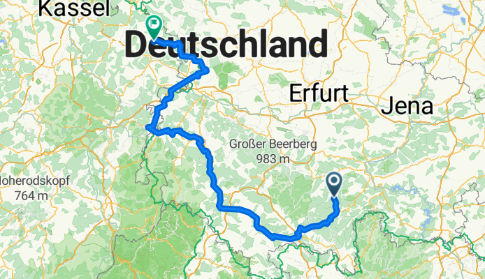
Werratal-Route Cursdorf-Eschwege
Cycling route in Cursdorf, Thuringia, Germany
- 234.7 km
- Distance
- 519 m
- Ascent
- 1,044 m
- Descent

Cursdorf - Deesbach - Talsperre Licht/Leibis - Unterweißbach-Sitzendorf Bhf
Cycling route in Cursdorf, Thuringia, Germany
- 20.1 km
- Distance
- 469 m
- Ascent
- 838 m
- Descent

Schulstraße 12, Cursdorf nach Zum Stausee, Scheibe-Alsbach
Cycling route in Cursdorf, Thuringia, Germany
- 16.7 km
- Distance
- 507 m
- Ascent
- 518 m
- Descent

Cursdorf - Mellenbachtal - Mellenbach-Glasbach
Cycling route in Cursdorf, Thuringia, Germany
- 6.1 km
- Distance
- 11 m
- Ascent
- 340 m
- Descent
Discover more routes
 Sonnenweg, Cursdorf nach Kuppenstraße 12, Meuselbach-Schwarzmühle
- Distance
- 10.7 km
- Ascent
- 229 m
- Descent
- 323 m
- Location
- Cursdorf, Thuringia, Germany
 Thüringen Tag 2.1
- Distance
- 7.9 km
- Ascent
- 206 m
- Descent
- 105 m
- Location
- Cursdorf, Thuringia, Germany
 panoramweg cursdorf bad blankenburg
- Distance
- 38.5 km
- Ascent
- 1,028 m
- Descent
- 1,443 m
- Location
- Cursdorf, Thuringia, Germany
 Ortsstraße 70, Cursdorf nach Schwindelweg, Bad Blankenburg
- Distance
- 48.3 km
- Ascent
- 1,404 m
- Descent
- 1,884 m
- Location
- Cursdorf, Thuringia, Germany
 Cursdorf, Hotel - Tal der Weißen Schwarza - Mellenbach-Glasbach
- Distance
- 16 km
- Ascent
- 161 m
- Descent
- 520 m
- Location
- Cursdorf, Thuringia, Germany