
Cycling in Verneuil-sur-Avre
Discover a map of 30 cycling routes and bike trails near Verneuil-sur-Avre, created by our community.
Region portrait
Get to know Verneuil-sur-Avre
Find the right bike route for you through Verneuil-sur-Avre, where we've got 30 cycle routes to explore.
1,405 km
Tracked distance
30
Cycle routes
7,229
Population
Community
Most active users in Verneuil-sur-Avre
From our community
The best bike routes in and around Verneuil-sur-Avre
2009 Euro Tour -- Ride Day 20 — 15 July 2009 — 27130 Verneuil-sur-Avre to 14100 Lisieux CLONED FROM ROUTE 1682062
Cycling route in Verneuil-sur-Avre, Normandy, France
<div class="MsoNormal" style="color: #000000; font-family: Helvetica; font-size: medium;"><span style="font-family: Arial;">
<div class="MsoNormal">
<div class="MsoNormal"><span style="font-family: Arial;">Nice ride today although we did have some strong headwinds.<span> </span>Happily in the latter half of the ride, we had some variety of terrain and excellent roads.</span></div>
<div class="MsoNormal"><span style="font-family: Arial;"> </span></div>
<div class="MsoNormal"><span style="font-family: Arial;">D137 had a terrible climb that warranted at least two arrows rather than the one arrow shown on the map.<span> </span>Right after the climb as we pedaled along D613 toward the Etap, it started to rain just as it had the previous day right before reaching our destination.</span></div>
</div>
<div class="MsoNormal"><br /></div>
</span><span style="font-family: Arial;">During the day, we passed for a couple of short periods from Eure Department in the Haute-Normandie Region into the Orne Department in the Basse-Normandie Region.  Eventually, we exited the Eure Department and passed into the Calvados Department, which is in the Basse-Normandie Region.</span><span style="font-family: Arial;">
<div class="MsoNormal"><span style="font-family: Arial;"> </span></div>
</span></div>
<div class="MsoNormal" style="color: #000000; font-family: Helvetica; font-size: medium;"><span style="font-family: Arial;">
<div class="MsoNormal">
<div class="MsoNormal"></div>
</div>
</div>
<div class="MsoNormal"><br /></div>
</span></div>
<div class="MsoNormal" style="color: #000000; font-family: Helvetica; font-size: medium;">Background:<span style="font-family: Arial;">
<div class="MsoNormal" style="font-size: 16px;"><span style="font-family: Arial;"> </span></div>
</span></div>
My wife and I have been doing self-supported tours in Western Europe (a majority in France) since 1993. Â This series of rides covers our 2009 4.5 month route through parts of France, Germany, Austria, Switzerland, and then back to France. Â Our beginning and ending point is near Chadurie (south of Angouleme) where our friends have a farm with Gites and Chambres d'Hotes.
We rode our Dawes touring bicycles purchased in 1993 heavily loaded with 700Cx32 tires. Â All of our riding was on paved roads, mostly with very little traffic. Â Pretty much the only unpaved sections were some bicycle paths in Germany and Austria. Sadly, that wasn't so great as Helen fell a number of times on the unpaved paths. Â Fortunately, though, no serious injury.
If any questions, feel free to email me at jeffkadet@netdiving.com
Jeff
- 80.4 km
- Distance
- 250 m
- Ascent
- 281 m
- Descent
Verneuil - Saint Sylvestre de Cormeilles
Cycling route in Verneuil-sur-Avre, Normandy, France
Verneuil - Saint Sylvestre de Cormeilles
- 93.5 km
- Distance
- 168 m
- Ascent
- 203 m
- Descent
V2 Verneuil-s-Arve / Paris 140km
Cycling route in Verneuil-sur-Avre, Normandy, France
- 140.7 km
- Distance
- 361 m
- Ascent
- 475 m
- Descent
Verneuil-Irai
Cycling route in Verneuil-sur-Avre, Normandy, France
- 24.9 km
- Distance
- 101 m
- Ascent
- 43 m
- Descent
Discover more routes
- 👌🏅
- Distance
- 28.8 km
- Ascent
- 234 m
- Descent
- 232 m
- Location
- Verneuil-sur-Avre, Normandy, France
- Verneuil sur Avre - La Fresnaie fayel
- Distance
- 63 km
- Ascent
- 424 m
- Descent
- 397 m
- Location
- Verneuil-sur-Avre, Normandy, France
- Verneuil d'Avre et d'Iton to Rue ville Close 3, BellĂŞme
- Distance
- 54 km
- Ascent
- 571 m
- Descent
- 523 m
- Location
- Verneuil-sur-Avre, Normandy, France
- 12–72 Route de Mortagne, Verneuil d'Avre et d'Iton à Les Barils
- Distance
- 9.3 km
- Ascent
- 164 m
- Descent
- 142 m
- Location
- Verneuil-sur-Avre, Normandy, France
- Verneuil-sur-Avre - Cherré
- Distance
- 84.4 km
- Ascent
- 629 m
- Descent
- 705 m
- Location
- Verneuil-sur-Avre, Normandy, France
- De Rue Aristide Briand, Verneuil d'Avre et d'Iton Ă 39 Rue Saint-Germain, Brezolles
- Distance
- 13 km
- Ascent
- 57 m
- Descent
- 59 m
- Location
- Verneuil-sur-Avre, Normandy, France
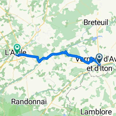
- De Place Saint-Jean 151, Verneuil d'Avre et d'Iton Ă Grande Rue 47, Le Gault-Perche
- Distance
- 100.5 km
- Ascent
- 879 m
- Descent
- 841 m
- Location
- Verneuil-sur-Avre, Normandy, France
- Verneuil sur Avre - Courtils
- Distance
- 213.9 km
- Ascent
- 570 m
- Descent
- 716 m
- Location
- Verneuil-sur-Avre, Normandy, France