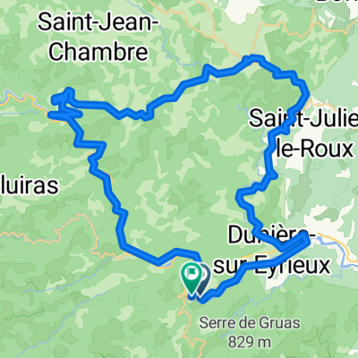
- 51.8 km
- 2,527 m
- 2,533 m
- Saint-Sauveur-de-Montagut, Auvergne-Rhône-Alpes, France

Cycling in Saint-Sauveur-de-Montagut
Discover a map of 133 cycling routes and bike trails near Saint-Sauveur-de-Montagut, created by our community.
Region portrait
Get to know Saint-Sauveur-de-Montagut
Find the right bike route for you through Saint-Sauveur-de-Montagut, where we've got 133 cycle routes to explore. Most people get on their bikes to ride here in the months of June and July.
6,651 km
Tracked distance
133
Cycle routes
1,332
Population
Community
Most active users in Saint-Sauveur-de-Montagut
Handpicked routes
Discover Saint-Sauveur-de-Montagut through these collections
From our community
The best bike routes in and around Saint-Sauveur-de-Montagut
2025 Pont de Cervil---Creas. ,Bahntrasse
Cycling route in Saint-Sauveur-de-Montagut, Auvergne-Rhône-Alpes, France
- 8.3 km
- Distance
- 391 m
- Ascent
- 315 m
- Descent
2016 Ride Day 108 - St-Sauveur-de-Montagut to Largentière
Cycling route in Saint-Sauveur-de-Montagut, Auvergne-Rhône-Alpes, France
- 69.2 km
- Distance
- 1,053 m
- Ascent
- 1,075 m
- Descent
Saint-Pierreville Runde
Cycling route in Saint-Sauveur-de-Montagut, Auvergne-Rhône-Alpes, France
- 37.4 km
- Distance
- 917 m
- Ascent
- 919 m
- Descent
Saint-Pierreville - Ucel
Cycling route in Saint-Sauveur-de-Montagut, Auvergne-Rhône-Alpes, France
- 58.1 km
- Distance
- 650 m
- Ascent
- 966 m
- Descent
Discover more routes
- 07 Route bei SF du Eyrieux
- les Ollières- les Vastres
- 62.4 km
- 2,360 m
- 1,310 m
- Saint-Sauveur-de-Montagut, Auvergne-Rhône-Alpes, France
- the nougat way
- 74.6 km
- 1,103 m
- 1,560 m
- Saint-Sauveur-de-Montagut, Auvergne-Rhône-Alpes, France
- Ardeche 1 - 29/04
- 60.9 km
- 1,486 m
- 555 m
- Saint-Sauveur-de-Montagut, Auvergne-Rhône-Alpes, France
- Saint-Sau -> Saou Mix velo-route
- 65.8 km
- 1,306 m
- 1,202 m
- Saint-Sauveur-de-Montagut, Auvergne-Rhône-Alpes, France
- Saint-Sau->Saou Smooth Ride
- 69.1 km
- 1,502 m
- 1,400 m
- Saint-Sauveur-de-Montagut, Auvergne-Rhône-Alpes, France
- Saint-Sau - Saou - Max VeloRoute
- 70.6 km
- 1,495 m
- 1,391 m
- Saint-Sauveur-de-Montagut, Auvergne-Rhône-Alpes, France
- entree
- 29.9 km
- 896 m
- 906 m
- Saint-Sauveur-de-Montagut, Auvergne-Rhône-Alpes, France


