Cycling in Saint-Gervais-d'Auvergne
Discover a map of 19 cycling routes and bike trails near Saint-Gervais-d'Auvergne, created by our community.
Region portrait
Get to know Saint-Gervais-d'Auvergne
Find the right bike route for you through Saint-Gervais-d'Auvergne, where we've got 19 cycle routes to explore.
1,457 km
Tracked distance
19
Cycle routes
1,512
Population
Community
Most active users in Saint-Gervais-d'Auvergne
From our community
The best bike routes in and around Saint-Gervais-d'Auvergne

2009 Euro Tour -- Ride Day 5 —25 June 2009—63390 Saint Gervais d'Auvergne to 03200 Vichy
Cycling route in Saint-Gervais-d'Auvergne, Auvergne-Rhône-Alpes, France
- 75.4 km
- Distance
- 479 m
- Ascent
- 942 m
- Descent

Fayolle-Oost
Cycling route in Saint-Gervais-d'Auvergne, Auvergne-Rhône-Alpes, France
- 42.3 km
- Distance
- 551 m
- Ascent
- 666 m
- Descent
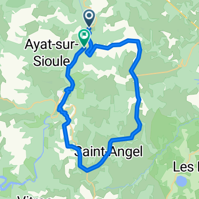
Fayolles-Saint Gervais
Cycling route in Saint-Gervais-d'Auvergne, Auvergne-Rhône-Alpes, France
- 26.5 km
- Distance
- 403 m
- Ascent
- 447 m
- Descent

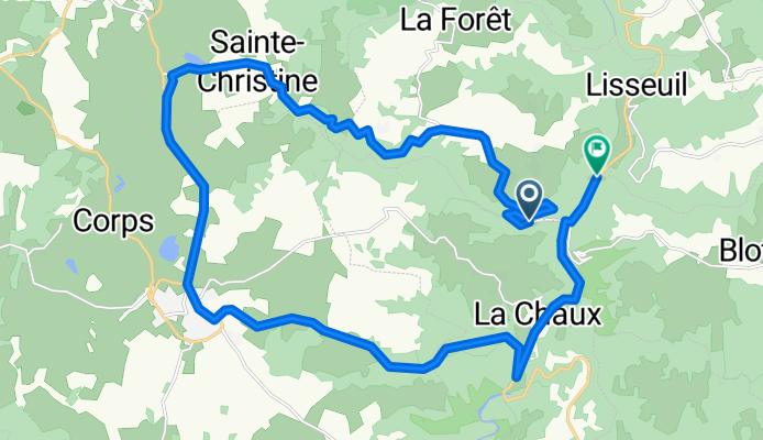
Fayolle-Sainte Christine
Cycling route in Saint-Gervais-d'Auvergne, Auvergne-Rhône-Alpes, France
- 28.1 km
- Distance
- 416 m
- Ascent
- 440 m
- Descent
Discover more routes
- All routes in Saint-Gervais-d'Auvergne
- Round trips
- Relaxed
- Gravel
- Road
- MTB
- Trekking
- De D227, Saint-Gervais-d'Auvergne à Route de Lamarche 2, Vonges0
- 307.3 km
- 346 m
- 869 m
- Saint-Gervais-d'Auvergne, Auvergne-Rhône-Alpes, France
- De Jouhet a Boussac-Bourg0
- 74.4 km
- 1,033 m
- 1,279 m
- Saint-Gervais-d'Auvergne, Auvergne-Rhône-Alpes, France
- 2 Rue Fontaine de la Ville, Saint-Gervais-d'Auvergne à Quai de Bacalan, Bordeaux1
- 353.5 km
- 3,463 m
- 4,178 m
- Saint-Gervais-d'Auvergne, Auvergne-Rhône-Alpes, France