Cycling in Uña
Discover a map of 21 cycling routes and bike trails near Uña, created by our community.
Region portrait
Get to know Uña
Find the right bike route for you through Uña, where we've got 21 cycle routes to explore.
1,019 km
Tracked distance
21
Cycle routes
138
Population
From our community
The best bike routes in and around Uña
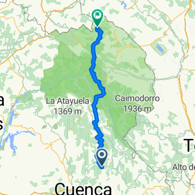
Ruta 29 : Serrania de Cuenca - etapa 2
Cycling route in Uña, Castille-La Mancha, Spain
- 60 km
- Distance
- 635 m
- Ascent
- 426 m
- Descent
Tramo Maraton Sendas de Cuenca 2015
Cycling route in Uña, Castille-La Mancha, Spain
- 36.6 km
- Distance
- 232 m
- Ascent
- 397 m
- Descent
Tramo I Maraton Sendas de Cuenca. Buenache de la Sierra.
Cycling route in Uña, Castille-La Mancha, Spain
- 25.9 km
- Distance
- 641 m
- Ascent
- 570 m
- Descent
Discover more routes
 Sendero PR-CU 37 (CGSC)
- Distance
- 11 km
- Ascent
- 332 m
- Descent
- 332 m
- Location
- Uña, Castille-La Mancha, Spain
 Cuenca — El Júcar: Villaba de la Sierra - Tragacete
- Distance
- 37.7 km
- Ascent
- 239 m
- Descent
- 269 m
- Location
- Uña, Castille-La Mancha, Spain
 ruta fuente tablas
- Distance
- 6.2 km
- Ascent
- 223 m
- Descent
- 224 m
- Location
- Uña, Castille-La Mancha, Spain
 Uña-Cuenca (7B)
- Distance
- 37 km
- Ascent
- 409 m
- Descent
- 616 m
- Location
- Uña, Castille-La Mancha, Spain
 Uña - Tragacete
- Distance
- 32 km
- Ascent
- 422 m
- Descent
- 271 m
- Location
- Uña, Castille-La Mancha, Spain
 uña mochales
- Distance
- 135.9 km
- Ascent
- 1,945 m
- Descent
- 1,840 m
- Location
- Uña, Castille-La Mancha, Spain
 03 uña- villalba
- Distance
- 16.4 km
- Ascent
- 384 m
- Descent
- 557 m
- Location
- Uña, Castille-La Mancha, Spain
 Uña BTT Mochales
- Distance
- 146.4 km
- Ascent
- 1,974 m
- Descent
- 2,131 m
- Location
- Uña, Castille-La Mancha, Spain


