
Cycling in Termeno
Discover a map of 530 cycling routes and bike trails near Termeno, created by our community.
Region portrait
Get to know Termeno
Find the right bike route for you through Termeno, where we've got 530 cycle routes to explore. Most people get on their bikes to ride here in the months of May and September.
32,622 km
Tracked distance
530
Cycle routes
2,853
Population


Handpicked routes
Discover Termeno through these collections
 Tour
Tour

From our community
The best bike routes in and around Termeno

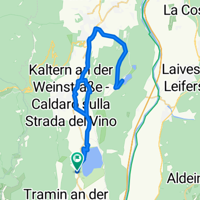
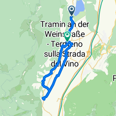
Kaltern an der Weinstraße nach Europastraße, Kaltern an der Weinstraße
Cycling route in Termeno, Trentino-Alto Adige, Italy
- 5.8 km
- Distance
- 287 m
- Ascent
- 13 m
- Descent

Sankt Josef am See, Kaltern an der Weinstraße nach Marktplatz, Kaltern an der Weinstraße
Cycling route in Termeno, Trentino-Alto Adige, Italy
- 7.9 km
- Distance
- 288 m
- Ascent
- 76 m
- Descent

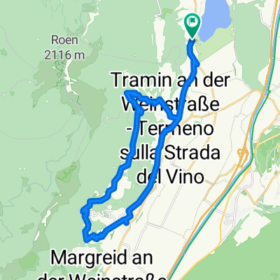
Sankt Josef am See, Kaltern an der Weinstraße nach Sankt Josef am See, Kaltern an der Weinstraße
Cycling route in Termeno, Trentino-Alto Adige, Italy
- 26.3 km
- Distance
- 451 m
- Ascent
- 452 m
- Descent


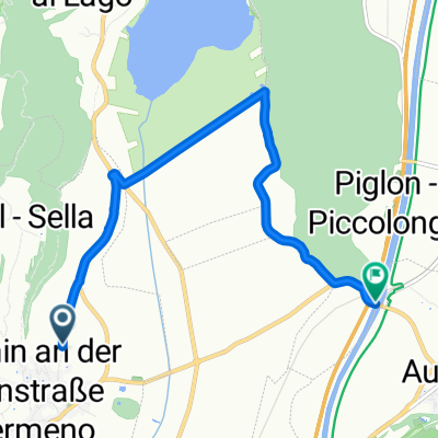
Auffahrt zum Lenzenhof
Cycling route in Termeno, Trentino-Alto Adige, Italy
- 7.9 km
- Distance
- 591 m
- Ascent
- 76 m
- Descent
Discover more routes
 Sankt Josef-Montiggl-St.Joseph am See
- Distance
- 32.6 km
- Ascent
- 561 m
- Descent
- 561 m
- Location
- Termeno, Trentino-Alto Adige, Italy
 St.Joseph-Montan-Auer-St.Joseph
- Distance
- 32.3 km
- Ascent
- 492 m
- Descent
- 491 m
- Location
- Termeno, Trentino-Alto Adige, Italy
 Sankt Josef am See, Kaltern an der Weinstraße nach Via Antonio Rosmini, Roverè della Luna/Aichholz
- Distance
- 19.4 km
- Ascent
- 530 m
- Descent
- 509 m
- Location
- Termeno, Trentino-Alto Adige, Italy
 Camping St. Josef - Tramin - Kurtatsch - Graun - St.Josef
- Distance
- 25 km
- Ascent
- 1,014 m
- Descent
- 1,013 m
- Location
- Termeno, Trentino-Alto Adige, Italy
 Josef Von Zallinger Straße nach Weingartenweg
- Distance
- 37.6 km
- Ascent
- 221 m
- Descent
- 199 m
- Location
- Termeno, Trentino-Alto Adige, Italy
 Sonngart nach Tramin
- Distance
- 34 km
- Ascent
- 264 m
- Descent
- 264 m
- Location
- Termeno, Trentino-Alto Adige, Italy
 Kaltererseestraße, Tramin an der Weinstraße nach Laimburg, Auer
- Distance
- 6.9 km
- Ascent
- 51 m
- Descent
- 101 m
- Location
- Termeno, Trentino-Alto Adige, Italy
 St.Joseph-Kurtatsch-Margreid-Entiklar-Tramin-St.Josepg
- Distance
- 21.6 km
- Ascent
- 399 m
- Descent
- 335 m
- Location
- Termeno, Trentino-Alto Adige, Italy
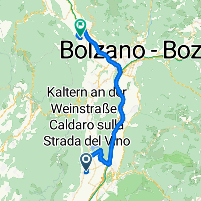
Routes to Termeno
By bicycle from
Caldaro sulla Strada del Vino to Termeno