
Cycling in Pragelato
Discover a map of 41 cycling routes and bike trails near Pragelato, created by our community.
Region portrait
Get to know Pragelato
Find the right bike route for you through Pragelato, where we've got 41 cycle routes to explore.
2,820 km
Tracked distance
41
Cycle routes
402
Population


From our community
The best bike routes in and around Pragelato

Pragelato - Militare - Setriere - Borgata - Plan - Pragelato
Cycling route in Pragelato, Piedmont, Italy
- 32 km
- Distance
- 1,206 m
- Ascent
- 1,206 m
- Descent


Tour delle Alpi Olimpiche - Olympic Alps Tour
Cycling route in Pragelato, Piedmont, Italy
- 113.1 km
- Distance
- 2,343 m
- Ascent
- 2,343 m
- Descent

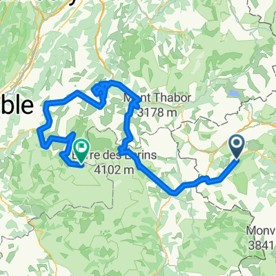
Pragelato - La Vachette
Cycling route in Pragelato, Piedmont, Italy
- 78.5 km
- Distance
- 2,164 m
- Ascent
- 2,163 m
- Descent
Discover more routes
 Pragelato - Les Deux Alpes-Glacier du Mont Lans
- Distance
- 276.8 km
- Ascent
- 7,733 m
- Descent
- 6,112 m
- Location
- Pragelato, Piedmont, Italy
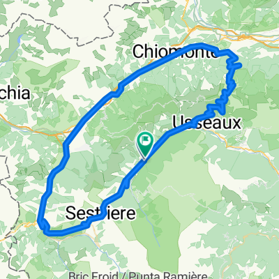 Pragelato - Sestriere - Meana di Susa - Colle delle Finestre - Usseaux - Pragelato
- Distance
- 91.2 km
- Ascent
- 2,135 m
- Descent
- 2,137 m
- Location
- Pragelato, Piedmont, Italy
 5-Soucheres Basses-Bessans (Finestre-Mont Cenis)
- Distance
- 83.4 km
- Ascent
- 2,950 m
- Descent
- 2,706 m
- Location
- Pragelato, Piedmont, Italy
 Etapa 4
- Distance
- 11.1 km
- Ascent
- 486 m
- Descent
- 78 m
- Location
- Pragelato, Piedmont, Italy
 Sestriere (e20 Giro)
- Distance
- 10.5 km
- Ascent
- 528 m
- Descent
- 0 m
- Location
- Pragelato, Piedmont, Italy
 Pragelato-Briancon ITT
- Distance
- 43.7 km
- Ascent
- 1,129 m
- Descent
- 1,424 m
- Location
- Pragelato, Piedmont, Italy
 Assietta 2
- Distance
- 76.1 km
- Ascent
- 1,960 m
- Descent
- 1,960 m
- Location
- Pragelato, Piedmont, Italy
 Da Strada Provinciale 23 del Colle di Sestriere 5, Pragelato-Ruà a Unnamed Road, Pragelato
- Distance
- 9.6 km
- Ascent
- 428 m
- Descent
- 25 m
- Location
- Pragelato, Piedmont, Italy