
Cycling in Certosa
Discover a map of 14 cycling routes and bike trails near Certosa, created by our community.
Region portrait
Get to know Certosa
Find the right bike route for you through Certosa, where we've got 14 cycle routes to explore.
494 km
Tracked distance
14
Cycle routes
263
Population
From our community
The best bike routes in and around Certosa

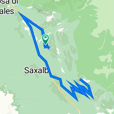
Zum Saxalbersee in Schnals - wandertour
Cycling route in Certosa, Trentino-Alto Adige, Italy
TEASI track
- 9.4 km
- Distance
- 1,138 m
- Ascent
- 1,130 m
- Descent

Zur Klosteralm in Schnals - wandertour
Cycling route in Certosa, Trentino-Alto Adige, Italy
TEASI track
- 6.4 km
- Distance
- 838 m
- Ascent
- 838 m
- Descent

anstieg oberversant
Cycling route in Certosa, Trentino-Alto Adige, Italy
- 3.1 km
- Distance
- 520 m
- Ascent
- 164 m
- Descent

Karthaus - Rabland
Cycling route in Certosa, Trentino-Alto Adige, Italy
Vintschgau
- 21 km
- Distance
- 34 m
- Ascent
- 838 m
- Descent
Discover more routes
 RadTag 2015 Ötztal
- Distance
- 37.7 km
- Ascent
- 1,129 m
- Descent
- 1,129 m
- Location
- Certosa, Trentino-Alto Adige, Italy
 tag 7
tag 7- Distance
- 83.3 km
- Ascent
- 3,654 m
- Descent
- 3,940 m
- Location
- Certosa, Trentino-Alto Adige, Italy
 ac2018d4
- Distance
- 73 km
- Ascent
- 3,001 m
- Descent
- 2,086 m
- Location
- Certosa, Trentino-Alto Adige, Italy
 ac2018d3
- Distance
- 124.9 km
- Ascent
- 2,243 m
- Descent
- 2,603 m
- Location
- Certosa, Trentino-Alto Adige, Italy
 Katharinaberg 89 nach Katharinaberg 89
- Distance
- 27.5 km
- Ascent
- 2,293 m
- Descent
- 2,293 m
- Location
- Certosa, Trentino-Alto Adige, Italy
 Schnalstalausgang_Trails
- Distance
- 8.7 km
- Ascent
- 133 m
- Descent
- 468 m
- Location
- Certosa, Trentino-Alto Adige, Italy
 3 Meraner Höhenweg
- Distance
- 12.2 km
- Ascent
- 972 m
- Descent
- 145 m
- Location
- Certosa, Trentino-Alto Adige, Italy
 MHW-3_6_katharinaberg_eishof
- Distance
- 12.2 km
- Ascent
- 1,011 m
- Descent
- 172 m
- Location
- Certosa, Trentino-Alto Adige, Italy