
Cycling in Paiçandu
Discover a map of 60 cycling routes and bike trails near Paiçandu, created by our community.
Region portrait
Get to know Paiçandu
Find the right bike route for you through Paiçandu, where we've got 60 cycle routes to explore. Most people get on their bikes to ride here in the month of May.
1,328 km
Tracked distance
60
Cycle routes
34,365
Population
Community
Most active users in Paiçandu


From our community
The best bike routes in and around Paiçandu


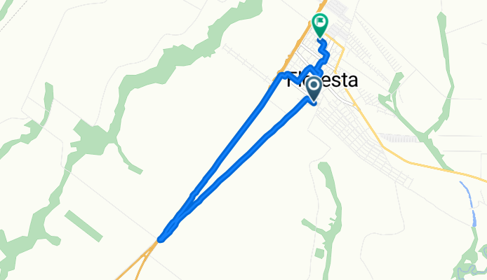
Rua Santa Catarina, Floresta a Rua 7 de Setembro, Floresta
Cycling route in Paiçandu, Paraná, Brazil
- 9.3 km
- Distance
- 67 m
- Ascent
- 85 m
- Descent


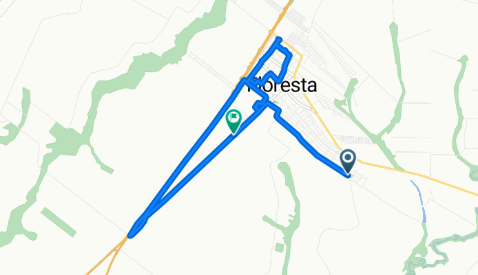
Rua Pioneiro Francisco Marangoni, Floresta a Floresta
Cycling route in Paiçandu, Paraná, Brazil
- 14.2 km
- Distance
- 103 m
- Ascent
- 82 m
- Descent

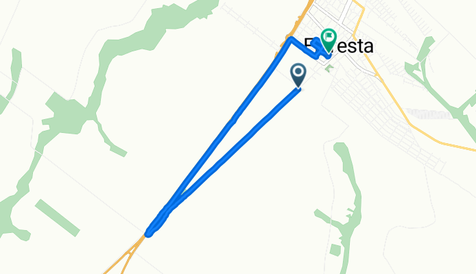
Avenida Getúlio Vargas, Floresta a Travessa Monte Carlo, Floresta
Cycling route in Paiçandu, Paraná, Brazil
- 8.2 km
- Distance
- 75 m
- Ascent
- 85 m
- Descent

Discover more routes
 dr camargo ivatuba
- Distance
- 76.9 km
- Ascent
- 540 m
- Descent
- 567 m
- Location
- Paiçandu, Paraná, Brazil
 agua boa - clube cobra
- Distance
- 10.1 km
- Ascent
- 223 m
- Descent
- 225 m
- Location
- Paiçandu, Paraná, Brazil
 floriano - agua boa - maringá
- Distance
- 46.1 km
- Ascent
- 509 m
- Descent
- 515 m
- Location
- Paiçandu, Paraná, Brazil
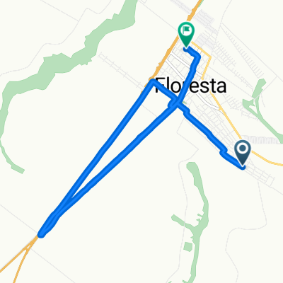
 Rua Pioneiro Francisco Marangoni, Floresta a Rua Joaquim Nabuco, Floresta
- Distance
- 13.7 km
- Ascent
- 118 m
- Descent
- 82 m
- Location
- Paiçandu, Paraná, Brazil
 07/01 🚴🏻♀️
- Distance
- 25.1 km
- Ascent
- 156 m
- Descent
- 120 m
- Location
- Paiçandu, Paraná, Brazil
 Rua Pioneiro Pascoal Zandonadi, Floresta a Rua Joaquim Nabuco, Floresta
- Distance
- 15.5 km
- Ascent
- 128 m
- Descent
- 133 m
- Location
- Paiçandu, Paraná, Brazil
 Paicandu x Cachoeira de Ourizona
- Distance
- 66 km
- Ascent
- 1,134 m
- Descent
- 1,135 m
- Location
- Paiçandu, Paraná, Brazil
 Paicandu / Aeroporto
- Distance
- 30.4 km
- Ascent
- 331 m
- Descent
- 332 m
- Location
- Paiçandu, Paraná, Brazil