
Cycling in Tulancingo
Discover a map of 74 cycling routes and bike trails near Tulancingo, created by our community.
Region portrait
Get to know Tulancingo
Find the right bike route for you through Tulancingo, where we've got 74 cycle routes to explore. Most people get on their bikes to ride here in the month of April.
1,179 km
Tracked distance
74
Cycle routes
102,383
Population
Community
Most active users in Tulancingo


From our community
The best bike routes in and around Tulancingo


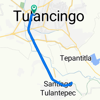
Calle Ignacio Zaragoza 109A, Tulancingo a Calle 5 de Mayo 44, Jaltepec
Cycling route in Tulancingo, Hidalgo, Mexico
- 29.5 km
- Distance
- 153 m
- Ascent
- 164 m
- Descent

Pahuatlanazo; Tulancingo - Pahuatlan
Cycling route in Tulancingo, Hidalgo, Mexico
- 42.4 km
- Distance
- 118 m
- Ascent
- 1,209 m
- Descent

De Libramiento la Joya, Tulancingo a Calle Chamizal 15, Tulancingo
Cycling route in Tulancingo, Hidalgo, Mexico
- 41.6 km
- Distance
- 1,197 m
- Ascent
- 1,149 m
- Descent

Calle 2, Tulancingo a Retorno Monte Albán 2, Tulancingo
Cycling route in Tulancingo, Hidalgo, Mexico
- 6 km
- Distance
- 9 m
- Ascent
- 23 m
- Descent
Discover more routes
 De Francisco Mendoza 606, Tulancingo de Bravo a Ignacio Zaragoza 319, Tulancingo de Bravo
- Distance
- 23.9 km
- Ascent
- 139 m
- Descent
- 84 m
- Location
- Tulancingo, Hidalgo, Mexico
 De Calle Cristóbal Colon 20, Tulancingo a Calle Cristóbal Colon 22, Tulancingo
- Distance
- 13.9 km
- Ascent
- 25 m
- Descent
- 22 m
- Location
- Tulancingo, Hidalgo, Mexico
 Ciclopista del Ferrocarril, Tulancingo a Calle 5 de Mayo 34, Jaltepec
- Distance
- 8.5 km
- Ascent
- 35 m
- Descent
- 37 m
- Location
- Tulancingo, Hidalgo, Mexico
 bike tour through Tulancingo
- Distance
- 16 km
- Ascent
- 93 m
- Descent
- 93 m
- Location
- Tulancingo, Hidalgo, Mexico
 De Calle Rio Panuco 18–20, Tulancingo a Calle Rio Panuco 18–20, Tulancingo
- Distance
- 13.2 km
- Ascent
- 46 m
- Descent
- 47 m
- Location
- Tulancingo, Hidalgo, Mexico
 Calle Rodolfo Guzmán Huerta Santo el Enmascarado de Plata 108, Tulancingo to Calle Rodolfo Guzmán Huerta Santo el Enmascarado de Plata 13, Tulancingo
- Distance
- 14.2 km
- Ascent
- 292 m
- Descent
- 296 m
- Location
- Tulancingo, Hidalgo, Mexico
 Los Alamos, Tulancingo to Calle Rodolfo Guzmán Huerta Santo el Enmascarado de Plata 13, Tulancingo
- Distance
- 16.8 km
- Ascent
- 86 m
- Descent
- 86 m
- Location
- Tulancingo, Hidalgo, Mexico
 Los Alamos, Tulancingo to Calle Rodolfo Guzmán Huerta Santo el Enmascarado de Plata 13, Tulancingo
- Distance
- 14.3 km
- Ascent
- 332 m
- Descent
- 334 m
- Location
- Tulancingo, Hidalgo, Mexico