
Cycling in Río Segundo
Discover a map of 11 cycling routes and bike trails near Río Segundo, created by our community.
Region portrait
Get to know Río Segundo
Find the right bike route for you through Río Segundo, where we've got 11 cycle routes to explore.
443 km
Tracked distance
11
Cycle routes
9,853
Population
Community
Most active users in Río Segundo


From our community
The best bike routes in and around Río Segundo

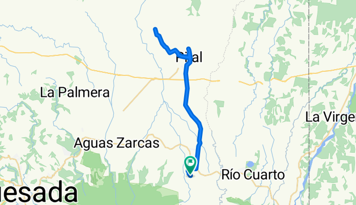
Laguna hule wiki
Cycling route in Río Segundo, Alajuela Province, Costa Rica
- 24.7 km
- Distance
- 617 m
- Ascent
- 617 m
- Descent

Ascenso de Cariblanco a Varablanca.
Cycling route in Río Segundo, Alajuela Province, Costa Rica
- 18.4 km
- Distance
- 1,222 m
- Ascent
- 149 m
- Descent

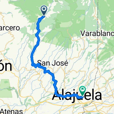
Descenso a Colonia
Cycling route in Río Segundo, Alajuela Province, Costa Rica
- 19.3 km
- Distance
- 61 m
- Ascent
- 1,322 m
- Descent
De Calle 2 a Calle 2
Cycling route in Río Segundo, Alajuela Province, Costa Rica
- 41.1 km
- Distance
- 628 m
- Ascent
- 622 m
- Descent
Discover more routes
 Costa Rica Rundtour 2010 - 08
- Distance
- 78.7 km
- Ascent
- 664 m
- Descent
- 934 m
- Location
- Río Segundo, Alajuela Province, Costa Rica
 Laguna Hule
- Distance
- 48.5 km
- Ascent
- 1,609 m
- Descent
- 1,605 m
- Location
- Río Segundo, Alajuela Province, Costa Rica
 From Sarchí to Desamparados
- Distance
- 44.9 km
- Ascent
- 1,645 m
- Descent
- 2,111 m
- Location
- Río Segundo, Alajuela Province, Costa Rica
 rio cuarto cariblanco bajos toro
- Distance
- 20.8 km
- Ascent
- 515 m
- Descent
- 413 m
- Location
- Río Segundo, Alajuela Province, Costa Rica
 PASO DE LAGUNA
- Distance
- 10 km
- Ascent
- 370 m
- Descent
- 275 m
- Location
- Río Segundo, Alajuela Province, Costa Rica
 día 3 Volcan Poas-La Fortuna
- Distance
- 112.3 km
- Ascent
- 2,350 m
- Descent
- 4,642 m
- Location
- Río Segundo, Alajuela Province, Costa Rica
 Bajos del Toro
- Distance
- 23.7 km
- Ascent
- 1,096 m
- Descent
- 139 m
- Location
- Río Segundo, Alajuela Province, Costa Rica