
Cycling in Banda del Río Salí
Discover a map of 59 cycling routes and bike trails near Banda del Río Salí, created by our community.
Region portrait
Get to know Banda del Río Salí
Find the right bike route for you through Banda del Río Salí, where we've got 59 cycle routes to explore. Most people get on their bikes to ride here in the months of August and November.
5,783 km
Tracked distance
59
Cycle routes
Community
Most active users in Banda del Río Salí


From our community
The best bike routes in and around Banda del Río Salí
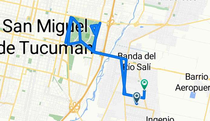
12 de Octubre, Municipalidad de Banda del Rio Sali a Ramón Paz Posse, Municipalidad de Banda del Rio Sali
Cycling route in Banda del Río Salí, Tucumán Province, Argentina
- 50 km
- Distance
- 344 m
- Ascent
- 340 m
- Descent

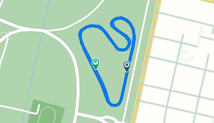
De Avenida Coronel Suárez a Avenida Coronel Suárez
Cycling route in Banda del Río Salí, Tucumán Province, Argentina
- 3 km
- Distance
- 3 m
- Ascent
- 39 m
- Descent

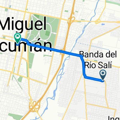
De Avenida Soldati SN a Avenida Soldati SN
Cycling route in Banda del Río Salí, Tucumán Province, Argentina
- 9.5 km
- Distance
- 39 m
- Ascent
- 20 m
- Descent
De Avenida Soldati SN a Avenida Soldati SN
Cycling route in Banda del Río Salí, Tucumán Province, Argentina
- 4.4 km
- Distance
- 6 m
- Ascent
- 40 m
- Descent
Discover more routes
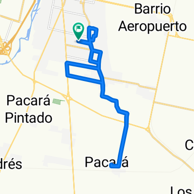
 De Avenida Coronel Suárez a Diego de Rojas
- Distance
- 12.2 km
- Ascent
- 21 m
- Descent
- 72 m
- Location
- Banda del Río Salí, Tucumán Province, Argentina
 Cycle for Heart 2010, Tucuman to Santiago del Estero
- Distance
- 155.4 km
- Ascent
- 96 m
- Descent
- 329 m
- Location
- Banda del Río Salí, Tucumán Province, Argentina
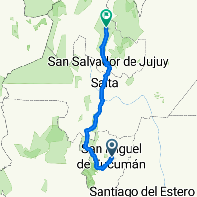
 Tucuman - Salta
- Distance
- 881.4 km
- Ascent
- 5,730 m
- Descent
- 2,301 m
- Location
- Banda del Río Salí, Tucumán Province, Argentina
 tucuman-catamarca-larioja
- Distance
- 381.5 km
- Ascent
- 873 m
- Descent
- 828 m
- Location
- Banda del Río Salí, Tucumán Province, Argentina
 01- Salida de Ruta desde Avenida Silvano Bores
- Distance
- 22 km
- Ascent
- 401 m
- Descent
- 169 m
- Location
- Banda del Río Salí, Tucumán Province, Argentina
 Américo Vespucio 670, Municipalidad de Banda del Rio Sali a Avenida Sáenz Peña 65, Municipalidad de San Miguel De Tucuman
- Distance
- 5.1 km
- Ascent
- 10 m
- Descent
- 3 m
- Location
- Banda del Río Salí, Tucumán Province, Argentina
 De de Mayo a de Mayo
- Distance
- 17.6 km
- Ascent
- 191 m
- Descent
- 225 m
- Location
- Banda del Río Salí, Tucumán Province, Argentina
 tucuman - humahuaca
- Distance
- 644.4 km
- Ascent
- 5,056 m
- Descent
- 2,513 m
- Location
- Banda del Río Salí, Tucumán Province, Argentina