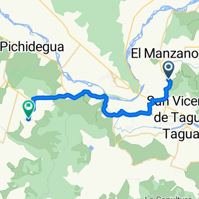
De H-50, Quinta de Tilcoco a Guacarhue-Quinta De Tilcoco 06, San Vicente de Taguatagua
- 15.7 km
- 93 m
- 141 m
- San Vicente, O'Higgins Region, Chile

Discover a map of 261 cycling routes and bike trails near San Vicente, created by our community.
Region portrait
Find the right bike route for you through San Vicente, where we've got 261 cycle routes to explore. Most people get on their bikes to ride here in the months of May and November.
5,701 km
Tracked distance
261
Cycle routes
22,572
Population
Community
From our community
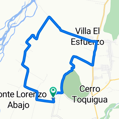
Cycling route in San Vicente, O'Higgins Region, Chile
Cycling route in San Vicente, O'Higgins Region, Chile


Cycling route in San Vicente, O'Higgins Region, Chile
Cycling route in San Vicente, O'Higgins Region, Chile