
Cycling in Auburn
Discover a map of 15 cycling routes and bike trails near Auburn, created by our community.
Region portrait
Get to know Auburn
Find the right bike route for you through Auburn, where we've got 15 cycle routes to explore.
397 km
Tracked distance
15
Cycle routes
6,887
Population
Community
Most active users in Auburn

From our community
The best bike routes in and around Auburn

Winder Rockwell Loop
Cycling route in Auburn, Georgia, United States
- 23.4 km
- Distance
- 244 m
- Ascent
- 243 m
- Descent


2315 Lake Cove Ct, Buford to Mantova Dr, Buford
Cycling route in Auburn, Georgia, United States
- 3.2 km
- Distance
- 49 m
- Ascent
- 37 m
- Descent

Rowan Court 357, Auburn to Rowan Court 357, Auburn
Cycling route in Auburn, Georgia, United States
- 23.3 km
- Distance
- 374 m
- Ascent
- 374 m
- Descent
Discover more routes
 419 Briarwood Rd, Winder to 991 Pine Acre Dr, Sugar Hill
- Distance
- 37.1 km
- Ascent
- 453 m
- Descent
- 421 m
- Location
- Auburn, Georgia, United States
 Briarwood Ln, Winder to 308 Briarwood Dr, Winder
- Distance
- 0.6 km
- Ascent
- 7 m
- Descent
- 0 m
- Location
- Auburn, Georgia, United States
 419 Briarwood Rd, Winder to 2369 Lawrenceville Hwy, Lawrenceville
- Distance
- 35 km
- Ascent
- 317 m
- Descent
- 330 m
- Location
- Auburn, Georgia, United States
 421 Briarwood Rd, Winder to 1959 Wickliffe Pl, Snellville
- Distance
- 35.8 km
- Ascent
- 411 m
- Descent
- 398 m
- Location
- Auburn, Georgia, United States
 3967–3997 Braselton Hwy, Buford to 620 Collingsworth Ln, Lawrenceville
- Distance
- 12.4 km
- Ascent
- 159 m
- Descent
- 181 m
- Location
- Auburn, Georgia, United States
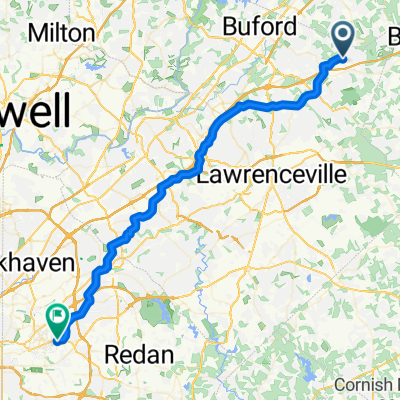 3440 Duncan Bridge Dr, Buford to 703 Twin Oaks Dr, Decatur
- Distance
- 60.6 km
- Ascent
- 618 m
- Descent
- 613 m
- Location
- Auburn, Georgia, United States
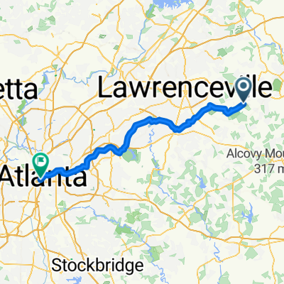 Auburn - Atlanta
- Distance
- 75.6 km
- Ascent
- 747 m
- Descent
- 732 m
- Location
- Auburn, Georgia, United States
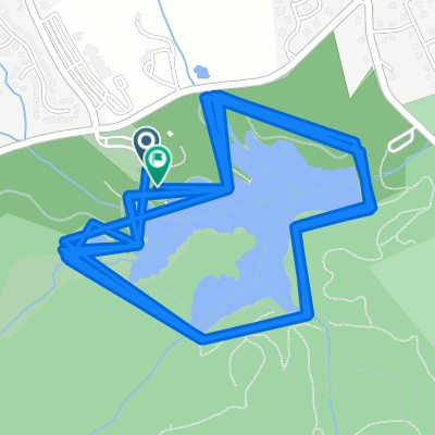 Auburn to Auburn
- Distance
- 25.5 km
- Ascent
- 223 m
- Descent
- 222 m
- Location
- Auburn, Georgia, United States