
Cycling in Rossmoyne
Discover a map of 19 cycling routes and bike trails near Rossmoyne, created by our community.
Region portrait
Get to know Rossmoyne
Find the right bike route for you through Rossmoyne, where we've got 19 cycle routes to explore.
318 km
Tracked distance
19
Cycle routes
2,230
Population

From our community
The best bike routes in and around Rossmoyne
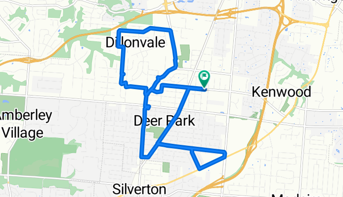
Plainfield-BlueAsh Route
Cycling route in Rossmoyne, Ohio, United States
- 16.1 km
- Distance
- 59 m
- Ascent
- 59 m
- Descent


BikeComputer Training Session
Cycling route in Rossmoyne, Ohio, United States
- 13 km
- Distance
- 49 m
- Ascent
- 51 m
- Descent
Discover more routes
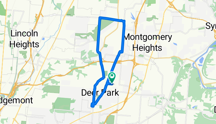
 hills deer park area
- Distance
- 9.6 km
- Ascent
- 41 m
- Descent
- 42 m
- Location
- Rossmoyne, Ohio, United States
 june24
- Distance
- 16.7 km
- Ascent
- 54 m
- Descent
- 53 m
- Location
- Rossmoyne, Ohio, United States
 090914
- Distance
- 22.7 km
- Ascent
- 160 m
- Descent
- 157 m
- Location
- Rossmoyne, Ohio, United States
 090114
- Distance
- 23 km
- Ascent
- 192 m
- Descent
- 195 m
- Location
- Rossmoyne, Ohio, United States
 090114
- Distance
- 23.1 km
- Ascent
- 182 m
- Descent
- 182 m
- Location
- Rossmoyne, Ohio, United States
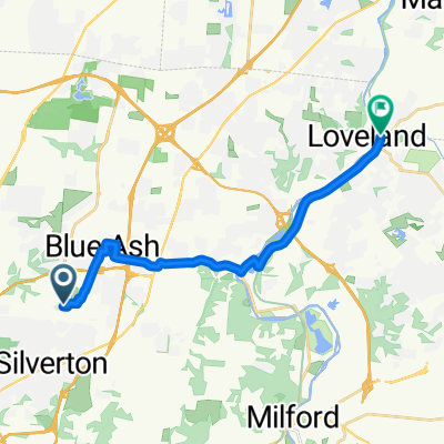 Plainfield Road 8470, Cincinnati to Karl Brown Way 126, Loveland
- Distance
- 17.5 km
- Ascent
- 49 m
- Descent
- 126 m
- Location
- Rossmoyne, Ohio, United States
 zone a
- Distance
- 9.7 km
- Ascent
- 30 m
- Descent
- 32 m
- Location
- Rossmoyne, Ohio, United States
 July 6 2014
- Distance
- 19.1 km
- Ascent
- 142 m
- Descent
- 139 m
- Location
- Rossmoyne, Ohio, United States