
Cycling in Georgetown
Discover a map of 10 cycling routes and bike trails near Georgetown, created by our community.
Region portrait
Get to know Georgetown
Find the right bike route for you through Georgetown, where we've got 10 cycle routes to explore.
554 km
Tracked distance
10
Cycle routes
9,163
Population
Community
Most active users in Georgetown


From our community
The best bike routes in and around Georgetown


Gemütliche Fahrt fu
Cycling route in Georgetown, South Carolina, United States
- 78.2 km
- Distance
- 290 m
- Ascent
- 298 m
- Descent
33.409° N -79.297° W nach 33.502° N -79.066° W
Cycling route in Georgetown, South Carolina, United States
- 41.5 km
- Distance
- 268 m
- Ascent
- 297 m
- Descent
33.409° N -79.297° W nach 33.430° N -79.144° W
Cycling route in Georgetown, South Carolina, United States
- 22 km
- Distance
- 99 m
- Ascent
- 111 m
- Descent
Discover more routes
 2088–2098 S-22-23, Georgetown to 432 Marina Dr, Georgetown
- Distance
- 15.3 km
- Ascent
- 13 m
- Descent
- 17 m
- Location
- Georgetown, South Carolina, United States
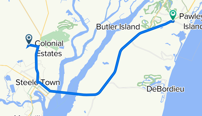
 125 N Fraser St, Georgetown to 71 Broad St, Charleston
- Distance
- 106.3 km
- Ascent
- 563 m
- Descent
- 553 m
- Location
- Georgetown, South Carolina, United States
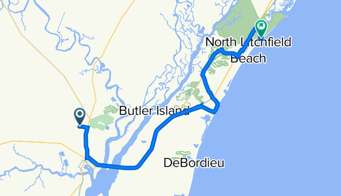
 221 S-22-805, Pawleys Island to 221 S-22-805, Pawleys Island
- Distance
- 2.5 km
- Ascent
- 43 m
- Descent
- 38 m
- Location
- Georgetown, South Carolina, United States
 Recovered Route
- Distance
- 100.2 km
- Ascent
- 144 m
- Descent
- 154 m
- Location
- Georgetown, South Carolina, United States
 S Fraser St, Georgetown to 3282–3298 N Santee River Rd, Georgetown
- Distance
- 5.6 km
- Ascent
- 48 m
- Descent
- 42 m
- Location
- Georgetown, South Carolina, United States
 East Coast Greenway (SC)
- Distance
- 20.8 km
- Ascent
- 3 m
- Descent
- 0 m
- Location
- Georgetown, South Carolina, United States