
Cycling in Walhalla
Discover a map of 13 cycling routes and bike trails near Walhalla, created by our community.
Region portrait
Get to know Walhalla
Find the right bike route for you through Walhalla, where we've got 13 cycle routes to explore.
2,270 km
Tracked distance
13
Cycle routes
4,263
Population


From our community
The best bike routes in and around Walhalla

My TNGA 2016
Cycling route in Walhalla, South Carolina, United States
- 269.1 km
- Distance
- 1,304 m
- Ascent
- 1,538 m
- Descent

Cracking ride in Walhalla
Cycling route in Walhalla, South Carolina, United States
- 22.9 km
- Distance
- 412 m
- Ascent
- 336 m
- Descent

picket to cashiers
Cycling route in Walhalla, South Carolina, United States
- 101.3 km
- Distance
- 1,180 m
- Ascent
- 1,180 m
- Descent

The Java Station 60 miler
Cycling route in Walhalla, South Carolina, United States
- 41.3 km
- Distance
- 428 m
- Ascent
- 430 m
- Descent
Discover more routes
 Jenny’s lake loop
- Distance
- 14.6 km
- Ascent
- 200 m
- Descent
- 195 m
- Location
- Walhalla, South Carolina, United States
 Trans North Georgia Trail
- Distance
- 545 km
- Ascent
- 3,645 m
- Descent
- 3,849 m
- Location
- Walhalla, South Carolina, United States
 Trans North Georgia 2015
- Distance
- 485.6 km
- Ascent
- 4,162 m
- Descent
- 4,461 m
- Location
- Walhalla, South Carolina, United States
 ToA19 v2 Greenville
- Distance
- 88.8 km
- Ascent
- 386 m
- Descent
- 415 m
- Location
- Walhalla, South Carolina, United States
 Trans North GA 1
- Distance
- 62.7 km
- Ascent
- 1,189 m
- Descent
- 1,017 m
- Location
- Walhalla, South Carolina, United States
 TNGA 2021 1.0
- Distance
- 575.9 km
- Ascent
- 15,041 m
- Descent
- 15,239 m
- Location
- Walhalla, South Carolina, United States
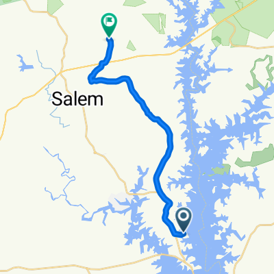 S Craggmore Dr, Salem to Shack Hollow Rd, Salem
- Distance
- 16.6 km
- Ascent
- 309 m
- Descent
- 220 m
- Location
- Walhalla, South Carolina, United States
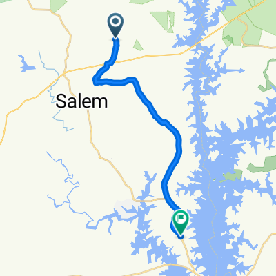 Shack Hollow Rd, Salem to Stamp Creek Rd, Salem
- Distance
- 15.6 km
- Ascent
- 145 m
- Descent
- 232 m
- Location
- Walhalla, South Carolina, United States