
Cycling in Roanoke
Discover a map of 34 cycling routes and bike trails near Roanoke, created by our community.
Region portrait
Get to know Roanoke
Find the right bike route for you through Roanoke, where we've got 34 cycle routes to explore.
8,410 km
Tracked distance
34
Cycle routes
97,032
Population
Community
Most active users in Roanoke


From our community
The best bike routes in and around Roanoke
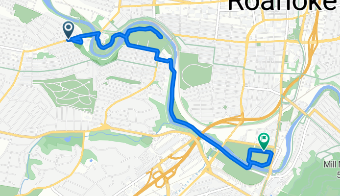
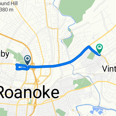
Lee Highway to Reserve Avenue Southwest
Cycling route in Roanoke, Virginia, United States
- 7.4 km
- Distance
- 48 m
- Ascent
- 30 m
- Descent

Bikeshare by RIDE Solutions
Cycling route in Roanoke, Virginia, United States
- 34.6 km
- Distance
- 112 m
- Ascent
- 123 m
- Descent

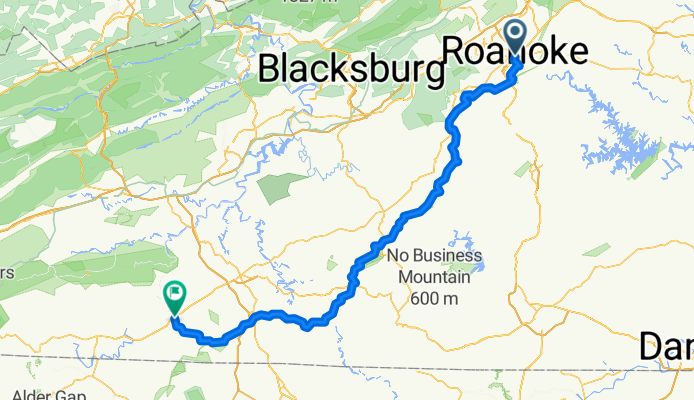
Roanoke/Peaks of Otter
Cycling route in Roanoke, Virginia, United States
- 62.5 km
- Distance
- 838 m
- Ascent
- 387 m
- Descent
Roanoke - Blue Ridge Parkway - Galax 166 km
Cycling route in Roanoke, Virginia, United States
- 165.9 km
- Distance
- 1,413 m
- Ascent
- 976 m
- Descent
Discover more routes
 Recovered Route
- Distance
- 5.3 km
- Ascent
- 51 m
- Descent
- 39 m
- Location
- Roanoke, Virginia, United States
 Roanoke to Lake House
- Distance
- 50.8 km
- Ascent
- 689 m
- Descent
- 691 m
- Location
- Roanoke, Virginia, United States
 030.Salem-Pulaski_94
- Distance
- 94.5 km
- Ascent
- 641 m
- Descent
- 349 m
- Location
- Roanoke, Virginia, United States
 testing
- Distance
- 0.7 km
- Ascent
- 12 m
- Descent
- 4 m
- Location
- Roanoke, Virginia, United States
 USA Etape 4 Roanoke-Fayetteville
- Distance
- 218.1 km
- Ascent
- 2,149 m
- Descent
- 1,912 m
- Location
- Roanoke, Virginia, United States
 592 Bridge St SW, Roanoke to 592 Bridge St SW, Roanoke
- Distance
- 21.5 km
- Ascent
- 338 m
- Descent
- 336 m
- Location
- Roanoke, Virginia, United States
 Kirk Avenue Southwest 18b, Roanoke to Peppers Ferry Road 150, Wytheville
- Distance
- 140.6 km
- Ascent
- 2,155 m
- Descent
- 1,729 m
- Location
- Roanoke, Virginia, United States
 Roanoke to Christiansburg
- Distance
- 71.1 km
- Ascent
- 1,286 m
- Descent
- 935 m
- Location
- Roanoke, Virginia, United States