Cycling in Marlinton
Discover a map of 26 cycling routes and bike trails near Marlinton, created by our community.
Region portrait
Get to know Marlinton
Find the right bike route for you through Marlinton, where we've got 26 cycle routes to explore.
1,205 km
Tracked distance
26
Cycle routes
1,054
Population
Community
Most active users in Marlinton
From our community
The best bike routes in and around Marlinton
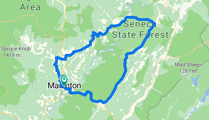
Marlinton Loop
Cycling route in Marlinton, West Virginia, United States
- 63.5 km
- Distance
- 1,209 m
- Ascent
- 1,208 m
- Descent
AML (over the ridge)
Cycling route in Marlinton, West Virginia, United States
- 92.8 km
- Distance
- 1,694 m
- Ascent
- 1,649 m
- Descent
Upper Scenic Highway Map
Cycling route in Marlinton, West Virginia, United States
- 39.7 km
- Distance
- 828 m
- Ascent
- 828 m
- Descent
Clover Lick - Observatory Route
Cycling route in Marlinton, West Virginia, United States
- 64.9 km
- Distance
- 552 m
- Ascent
- 555 m
- Descent
Discover more routes
 Marlinton-Cloverlick Loop
- Distance
- 62.8 km
- Ascent
- 537 m
- Descent
- 537 m
- Location
- Marlinton, West Virginia, United States
 Clover Lick - Green Bank
- Distance
- 50.3 km
- Ascent
- 546 m
- Descent
- 546 m
- Location
- Marlinton, West Virginia, United States
 Assault on Droop Mountain - Mountain State Wheelers
- Distance
- 74.8 km
- Ascent
- 1,016 m
- Descent
- 1,016 m
- Location
- Marlinton, West Virginia, United States
 Hillsboro - Droop - Locust Creek Loop
- Distance
- 28.6 km
- Ascent
- 421 m
- Descent
- 421 m
- Location
- Marlinton, West Virginia, United States
 Assault on Droop Mountain
- Distance
- 73.7 km
- Ascent
- 1,053 m
- Descent
- 1,053 m
- Location
- Marlinton, West Virginia, United States
 Lobelia Loop
- Distance
- 39.3 km
- Ascent
- 690 m
- Descent
- 690 m
- Location
- Marlinton, West Virginia, United States
 Three-Mountain Ride CLONED FROM ROUTE 216425
- Distance
- 110.7 km
- Ascent
- 1,909 m
- Descent
- 1,711 m
- Location
- Marlinton, West Virginia, United States
 Hillsboro-Lobelia Loop
- Distance
- 28.7 km
- Ascent
- 571 m
- Descent
- 571 m
- Location
- Marlinton, West Virginia, United States


