
Cycling in Parsons
Discover a map of 26 cycling routes and bike trails near Parsons, created by our community.
Region portrait
Get to know Parsons
Find the right bike route for you through Parsons, where we've got 26 cycle routes to explore.
1,358 km
Tracked distance
26
Cycle routes
1,485
Population


From our community
The best bike routes in and around Parsons
Allegheny Highlands Trail of Wv, Parsons to Main St, Parsons
Cycling route in Parsons, West Virginia, United States
- 42.2 km
- Distance
- 531 m
- Ascent
- 527 m
- Descent

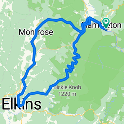
Limestone Mt. Loop
Cycling route in Parsons, West Virginia, United States
- 33.4 km
- Distance
- 587 m
- Ascent
- 587 m
- Descent

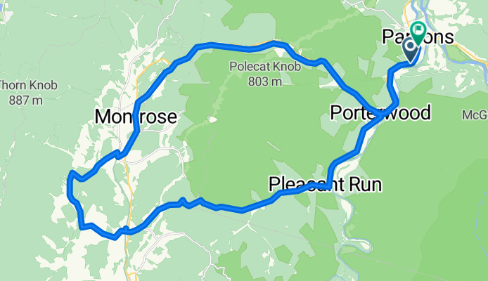
Parsons-Montrose Loop
Cycling route in Parsons, West Virginia, United States
- 61.5 km
- Distance
- 604 m
- Ascent
- 602 m
- Descent

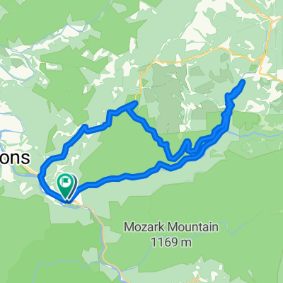
Horseshoe - Limestone Mt. Ride
Cycling route in Parsons, West Virginia, United States
- 55 km
- Distance
- 677 m
- Ascent
- 677 m
- Descent
Discover more routes
 Texas Mountain
- Distance
- 34.7 km
- Ascent
- 502 m
- Descent
- 502 m
- Location
- Parsons, West Virginia, United States
 Pifer Mountain Loop
- Distance
- 31.4 km
- Ascent
- 557 m
- Descent
- 557 m
- Location
- Parsons, West Virginia, United States
 Backbone Mountain Climb
- Distance
- 8.7 km
- Ascent
- 534 m
- Descent
- 26 m
- Location
- Parsons, West Virginia, United States
 Olson Fire Tower to Parsons
- Distance
- 35.8 km
- Ascent
- 96 m
- Descent
- 710 m
- Location
- Parsons, West Virginia, United States
 BW falls to Parsons to Deck Creek to apt
- Distance
- 124.3 km
- Ascent
- 959 m
- Descent
- 1,571 m
- Location
- Parsons, West Virginia, United States
 Route in Hendricks
- Distance
- 83.8 km
- Ascent
- 1,531 m
- Descent
- 1,531 m
- Location
- Parsons, West Virginia, United States
 Bfalls to Moundsville
- Distance
- 201.5 km
- Ascent
- 1,391 m
- Descent
- 2,151 m
- Location
- Parsons, West Virginia, United States
 Second St, Hendricks to Allegheny Highlands Trail of Wv, Hendricks
- Distance
- 39.5 km
- Ascent
- 798 m
- Descent
- 794 m
- Location
- Parsons, West Virginia, United States