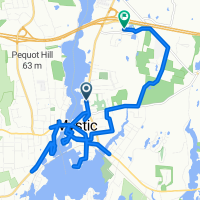
Cycling in Mystic
Discover a map of 25 cycling routes and bike trails near Mystic, created by our community.
Region portrait
Get to know Mystic
Find the right bike route for you through Mystic, where we've got 25 cycle routes to explore.
550 km
Tracked distance
25
Cycle routes
4,205
Population
Community
Most active users in Mystic
From our community
The best bike routes in and around Mystic
West Main Mystic, Latimer Pt, Mistuxet Ave, back to West Main
Cycling route in Mystic, Connecticut, United States
- 12 km
- Distance
- 84 m
- Ascent
- 81 m
- Descent
17 Water St, New London to 31 Water St, New London
Cycling route in Mystic, Connecticut, United States
- 45.6 km
- Distance
- 410 m
- Ascent
- 412 m
- Descent
Mystic Bike Shop
Cycling route in Mystic, Connecticut, United States
- 6.5 km
- Distance
- 108 m
- Ascent
- 78 m
- Descent
Discover more routes
 mystic to aquarium
- Distance
- 28.2 km
- Ascent
- 266 m
- Descent
- 266 m
- Location
- Mystic, Connecticut, United States
 200–298 Allyn St, Mystic to 15 Old Colony Ln, Ledyard
- Distance
- 11.6 km
- Ascent
- 130 m
- Descent
- 133 m
- Location
- Mystic, Connecticut, United States
 20 Mile Road Ride
- Distance
- 31.8 km
- Ascent
- 108 m
- Descent
- 110 m
- Location
- Mystic, Connecticut, United States
 River Road
- Distance
- 16.7 km
- Ascent
- 176 m
- Descent
- 177 m
- Location
- Mystic, Connecticut, United States
 Bruggeman Pl, Mystic to Mystic
- Distance
- 15.8 km
- Ascent
- 110 m
- Descent
- 106 m
- Location
- Mystic, Connecticut, United States
 FPL noank
- Distance
- 25.1 km
- Ascent
- 46 m
- Descent
- 95 m
- Location
- Mystic, Connecticut, United States
 Gallup Hill Loop
- Distance
- 34.7 km
- Ascent
- 258 m
- Descent
- 258 m
- Location
- Mystic, Connecticut, United States
 21 Godfrey St, Mystic to 1382–1398 RT-12, Gales Ferry
- Distance
- 13 km
- Ascent
- 136 m
- Descent
- 153 m
- Location
- Mystic, Connecticut, United States


