
Cycling in Arlington
Discover a map of 405 cycling routes and bike trails near Arlington, created by our community.
Region portrait
Get to know Arlington
Find the right bike route for you through Arlington, where we've got 405 cycle routes to explore. Most people get on their bikes to ride here in the months of June and July.
10,793 km
Tracked distance
405
Cycle routes
42,844
Population
Community
Most active users in Arlington


From our community
The best bike routes in and around Arlington

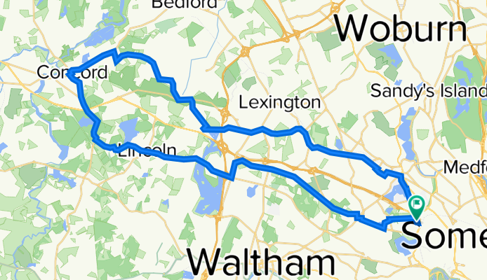
Walden Pond Loop From Hunnewell Hill
Cycling route in Arlington, Massachusetts, United States
- 63.9 km
- Distance
- 506 m
- Ascent
- 482 m
- Descent

Cambridge to Gore Place
Cycling route in Arlington, Massachusetts, United States
Mostly on dedicated multi use paths. Press pedestrian crossing buttons. Go on sidewalk on bridge crossings.
You want South side of Charles River. Fewer road crossings.
Alewife to Watertown on Watertown-Cambridge Greenway. Press Ped Crossing button on Arlington St crossing (for all ways ped light and you go diagonal).
Go through Arsenal Talcott Ave. Cross road and bridge on sidewalk.
Take the path on South part of Charles river all the way to Waltham.
Cross BRIDGE ST bridge on sidewalk (there's no curbcut anyway). Tight sidewalk.
Waltham St East of Stanley Ave is low traffic. Waltham St West of Stanley Ave has marked bike lanes.
Enter South entrance of Gore Place. (Main entrance is on the West side).
- 10.5 km
- Distance
- 68 m
- Ascent
- 57 m
- Descent
Walden Pond - Walden Pond
Cycling route in Arlington, Massachusetts, United States
Road: Concord and Walden Pond, where you can swim! - Road: Concord and Walden Pond, where you can swim!
- 46.6 km
- Distance
- 459 m
- Ascent
- 458 m
- Descent

Walden Pond + deCordova
Cycling route in Arlington, Massachusetts, United States
- 44.4 km
- Distance
- 228 m
- Ascent
- 228 m
- Descent
Discover more routes
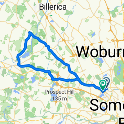
 Arlington Lexington Burlington Woburn Winchester Loop
- Distance
- 25.3 km
- Ascent
- 108 m
- Descent
- 108 m
- Location
- Arlington, Massachusetts, United States
 Minuteman Loop
- Distance
- 45.1 km
- Ascent
- 344 m
- Descent
- 346 m
- Location
- Arlington, Massachusetts, United States
 Cambridge Watertown Loop
- Distance
- 43.8 km
- Ascent
- 244 m
- Descent
- 244 m
- Location
- Arlington, Massachusetts, United States
 Harvard Groton loop
- Distance
- 125.7 km
- Ascent
- 807 m
- Descent
- 817 m
- Location
- Arlington, Massachusetts, United States
 Strawberry Hill Curve street Loop CLONED FROM ROUTE 183722
- Distance
- 57.5 km
- Ascent
- 315 m
- Descent
- 305 m
- Location
- Arlington, Massachusetts, United States
 Lynn Beach
- Distance
- 33.7 km
- Ascent
- 163 m
- Descent
- 214 m
- Location
- Arlington, Massachusetts, United States
 End of the Bike Path and Back
- Distance
- 27.8 km
- Ascent
- 4 m
- Descent
- 18 m
- Location
- Arlington, Massachusetts, United States
 Arlington - Carlyle Loop
- Distance
- 46.8 km
- Ascent
- 201 m
- Descent
- 192 m
- Location
- Arlington, Massachusetts, United States
Routes from Arlington
Quick ride by bicycle from
Arlington to Cambridge