
Cycling in Holyoke
Discover a map of 68 cycling routes and bike trails near Holyoke, created by our community.
Region portrait
Get to know Holyoke
Find the right bike route for you through Holyoke, where we've got 68 cycle routes to explore. Most people get on their bikes to ride here in the months of June and July.
2,434 km
Tracked distance
68
Cycle routes
39,880
Population
Community
Most active users in Holyoke


From our community
The best bike routes in and around Holyoke
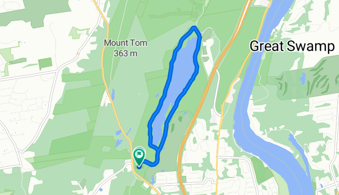
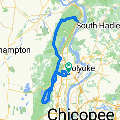
New England National Scenic Trail, Holyoke to Old Easthampton Rd, Holyoke
Cycling route in Holyoke, Massachusetts, United States
- 6.4 km
- Distance
- 76 m
- Ascent
- 79 m
- Descent
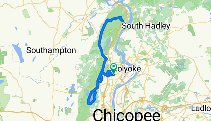
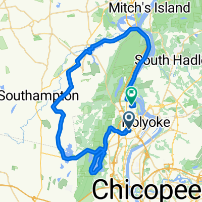
Portland St, Holyoke to Portland St, Holyoke
Cycling route in Holyoke, Massachusetts, United States
- 53.5 km
- Distance
- 547 m
- Ascent
- 563 m
- Descent

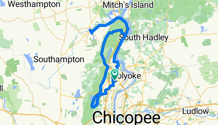
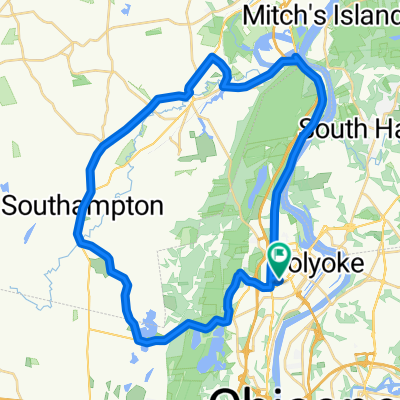
Rock Valley, Holyoke to Portland St, Holyoke
Cycling route in Holyoke, Massachusetts, United States
- 60.8 km
- Distance
- 476 m
- Ascent
- 508 m
- Descent
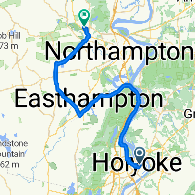
Portland St, Holyoke to Portland St, Holyoke
Cycling route in Holyoke, Massachusetts, United States
- 40.9 km
- Distance
- 619 m
- Ascent
- 620 m
- Descent
Discover more routes
 Work Test 1 Komoot
- Distance
- 16.5 km
- Ascent
- 48 m
- Descent
- 83 m
- Location
- Holyoke, Massachusetts, United States
 Work test 2
- Distance
- 35.8 km
- Ascent
- 188 m
- Descent
- 212 m
- Location
- Holyoke, Massachusetts, United States
 Holyoke-NOHO loop
- Distance
- 54.5 km
- Ascent
- 572 m
- Descent
- 568 m
- Location
- Holyoke, Massachusetts, United States
 Portland St, Holyoke to Wellesley Rd, Holyoke
- Distance
- 44 km
- Ascent
- 458 m
- Descent
- 457 m
- Location
- Holyoke, Massachusetts, United States
 Portland St, Holyoke to Portland St, Holyoke
- Distance
- 39.9 km
- Ascent
- 614 m
- Descent
- 611 m
- Location
- Holyoke, Massachusetts, United States
 Portland St, Holyoke to Portland St, Holyoke
- Distance
- 42.7 km
- Ascent
- 376 m
- Descent
- 373 m
- Location
- Holyoke, Massachusetts, United States
 Portland St, Holyoke to Portland St, Holyoke
- Distance
- 56.6 km
- Ascent
- 438 m
- Descent
- 442 m
- Location
- Holyoke, Massachusetts, United States
 Holyoke-Florence thru downtown EHO
- Distance
- 31.9 km
- Ascent
- 168 m
- Descent
- 112 m
- Location
- Holyoke, Massachusetts, United States