
Cycling in Milton
Discover a map of 181 cycling routes and bike trails near Milton, created by our community.
Region portrait
Get to know Milton
Find the right bike route for you through Milton, where we've got 181 cycle routes to explore. Most people get on their bikes to ride here in the months of June and August.
7,685 km
Tracked distance
181
Cycle routes
27,003
Population
Community
Most active users in Milton


From our community
The best bike routes in and around Milton

Blue Hills Reservation - Skyline trail
Cycling route in Milton, Massachusetts, United States
- 2.9 km
- Distance
- 79 m
- Ascent
- 76 m
- Descent

East Milton Around Ponkapoag
Cycling route in Milton, Massachusetts, United States
South on MA 28, across Randolph Street, North on MA 138, and Canton Ave. 16.65 miles
- 26.8 km
- Distance
- 237 m
- Ascent
- 233 m
- Descent

East Milton around Franklin Park
Cycling route in Milton, Massachusetts, United States
- 17.1 km
- Distance
- 118 m
- Ascent
- 119 m
- Descent

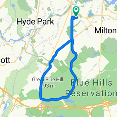
Blue Hills 1
Cycling route in Milton, Massachusetts, United States
- 31.2 km
- Distance
- 307 m
- Ascent
- 307 m
- Descent
Discover more routes
 Blue Hill Loop
- Distance
- 15.2 km
- Ascent
- 142 m
- Descent
- 140 m
- Location
- Milton, Massachusetts, United States
 Blue Hills, Sawcut Notch Path, 4.6km round
- Distance
- 4.6 km
- Ascent
- 83 m
- Descent
- 83 m
- Location
- Milton, Massachusetts, United States
 Moderate route in Boston
- Distance
- 5.4 km
- Ascent
- 0 m
- Descent
- 8 m
- Location
- Milton, Massachusetts, United States
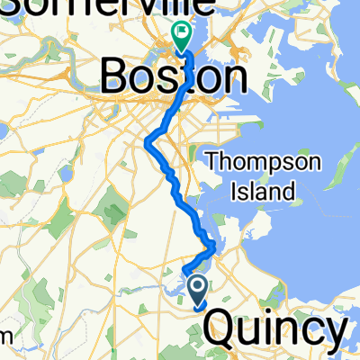
 Neponset River Trail, Boston to Boston
- Distance
- 10 km
- Ascent
- 72 m
- Descent
- 37 m
- Location
- Milton, Massachusetts, United States
 19 Squantum St, Milton to 36 Hull St, Boston
- Distance
- 16.5 km
- Ascent
- 10 m
- Descent
- 0 m
- Location
- Milton, Massachusetts, United States
 Milton on Dorchester Ave to 132 Boylston St, Boston
- Distance
- 12.4 km
- Ascent
- 10 m
- Descent
- 0 m
- Location
- Milton, Massachusetts, United States
 To Boylston St, Boston
- Distance
- 14.5 km
- Ascent
- 10 m
- Descent
- 0 m
- Location
- Milton, Massachusetts, United States
 Centre Street 47, Milton to Centre Street 47, Milton
- Distance
- 28.7 km
- Ascent
- 226 m
- Descent
- 230 m
- Location
- Milton, Massachusetts, United States