
Cycling in Plympton
Discover a map of 9 cycling routes and bike trails near Plympton, created by our community.
Region portrait
Get to know Plympton
Find the right bike route for you through Plympton, where we've got 9 cycle routes to explore.
262 km
Tracked distance
9
Cycle routes
2,683
Population
Community
Most active users in Plympton


From our community
The best bike routes in and around Plympton

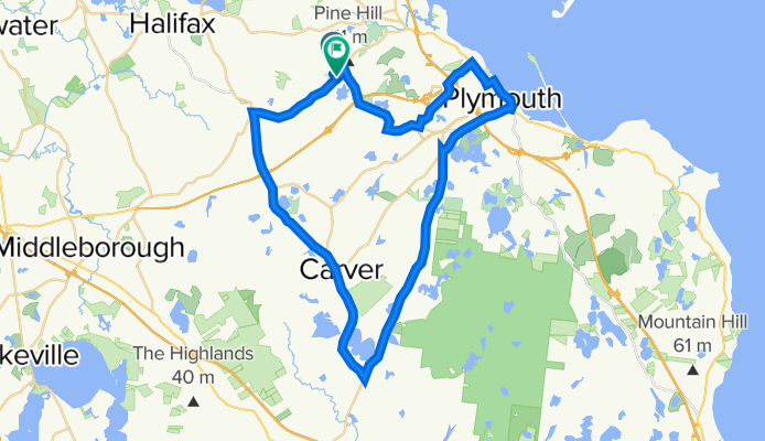
Assawompsett Tour
Cycling route in Plympton, Massachusetts, United States
- 49.5 km
- Distance
- 211 m
- Ascent
- 218 m
- Descent

Hingham Ferry via Wompatuck State Park
Cycling route in Plympton, Massachusetts, United States
- 44.5 km
- Distance
- 178 m
- Ascent
- 197 m
- Descent

Swim at Sampson's Pond
Cycling route in Plympton, Massachusetts, United States
- 39.6 km
- Distance
- 134 m
- Ascent
- 136 m
- Descent
Colony Place Plym-Carver (31.5 mi)
Cycling route in Plympton, Massachusetts, United States
- 50.7 km
- Distance
- 442 m
- Ascent
- 437 m
- Descent
Discover more routes
 Ride to Dux Beach (20 mi)
- Distance
- 17 km
- Ascent
- 152 m
- Descent
- 194 m
- Location
- Plympton, Massachusetts, United States
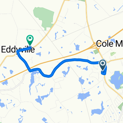
 Winnetuxet Bogg's 6/10/13
- Distance
- 7.4 km
- Ascent
- 70 m
- Descent
- 70 m
- Location
- Plympton, Massachusetts, United States
 68 N Main St, Carver to 176 Plympton St, Middleboro
- Distance
- 6 km
- Ascent
- 52 m
- Descent
- 61 m
- Location
- Plympton, Massachusetts, United States
 Market Basket Route
- Distance
- 24 km
- Ascent
- 188 m
- Descent
- 188 m
- Location
- Plympton, Massachusetts, United States
 Carver (28.4 mi)
- Distance
- 22.9 km
- Ascent
- 149 m
- Descent
- 167 m
- Location
- Plympton, Massachusetts, United States