
Cycling in South Boston
Discover a map of 354 cycling routes and bike trails near South Boston, created by our community.
Region portrait
Get to know South Boston
Find the right bike route for you through South Boston, where we've got 354 cycle routes to explore. Most people get on their bikes to ride here in the months of April and July.
4,888 km
Tracked distance
354
Cycle routes
571,281
Population
Community
Most active users in South Boston


Handpicked routes
Discover South Boston through these collections
From our community
The best bike routes in and around South Boston

Bicycle ride from SouthEnd to Needham and Back.
Cycling route in South Boston, Massachusetts, United States of America
- 26.9 km
- Distance
- 165 m
- Ascent
- 168 m
- Descent


Steady ride in Boston
Cycling route in South Boston, Massachusetts, United States of America
- 4 km
- Distance
- 79 m
- Ascent
- 92 m
- Descent


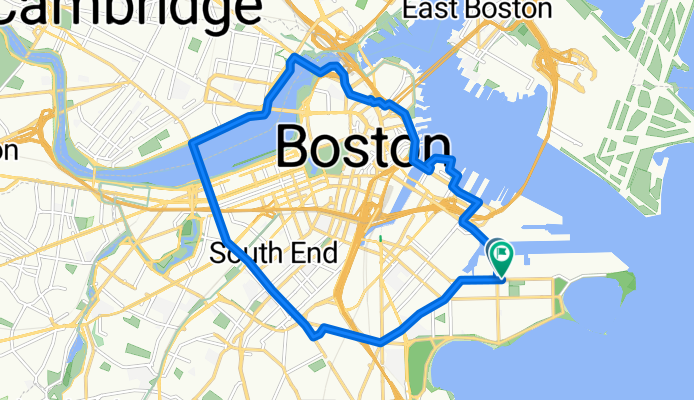
Boston
Cycling route in South Boston, Massachusetts, United States of America
- 16.2 km
- Distance
- 291 m
- Ascent
- 297 m
- Descent

DeBurgo Loop
Cycling route in South Boston, Massachusetts, United States of America
- 47.6 km
- Distance
- 436 m
- Ascent
- 434 m
- Descent
Discover more routes
 2011 Harpoon Brewery-to-Brewery Ride
- Distance
- 236.8 km
- Ascent
- 980 m
- Descent
- 873 m
- Location
- South Boston, Massachusetts, United States of America
 Dorchester Southie Pleasure Cruise
- Distance
- 38.6 km
- Ascent
- 119 m
- Descent
- 119 m
- Location
- South Boston, Massachusetts, United States of America
 castle island
- Distance
- 15.7 km
- Ascent
- 28 m
- Descent
- 29 m
- Location
- South Boston, Massachusetts, United States of America
 Savin Hill southern path
- Distance
- 10.3 km
- Ascent
- 36 m
- Descent
- 31 m
- Location
- South Boston, Massachusetts, United States of America
 Charles River
- Distance
- 24.2 km
- Ascent
- 109 m
- Descent
- 112 m
- Location
- South Boston, Massachusetts, United States of America
 pratt/Phil Black Falcon Criterium
- Distance
- 1.8 km
- Ascent
- 10 m
- Descent
- 11 m
- Location
- South Boston, Massachusetts, United States of America
 Short bike tour through Boston
- Distance
- 9.6 km
- Ascent
- 66 m
- Descent
- 66 m
- Location
- South Boston, Massachusetts, United States of America
 7 St Casimir St, Boston to 37 Symphony Rd, Boston
- Distance
- 3.8 km
- Ascent
- 10 m
- Descent
- 11 m
- Location
- South Boston, Massachusetts, United States of America
Routes from South Boston
Quick ride by bicycle from
South Boston to Boston
Routes to South Boston
Quick ride by bicycle from
Brookline to South Boston
Quick ride by bicycle from
Boston to South Boston