
Cycling in Boothbay Harbor
Discover a map of 49 cycling routes and bike trails near Boothbay Harbor, created by our community.
Region portrait
Get to know Boothbay Harbor
Find the right bike route for you through Boothbay Harbor, where we've got 49 cycle routes to explore. Most people get on their bikes to ride here in the months of June and October.
899 km
Tracked distance
49
Cycle routes
1,086
Population
Community
Most active users in Boothbay Harbor


From our community
The best bike routes in and around Boothbay Harbor

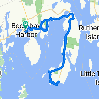
23 Atlantic Ave, Boothbay Harbor to 24 Atlantic Ave, Boothbay Harbor
Cycling route in Boothbay Harbor, State of Maine, United States
- 14.1 km
- Distance
- 206 m
- Ascent
- 205 m
- Descent

1–99 High St, Boothbay Harbor to 24 Atlantic Ave, Boothbay Harbor
Cycling route in Boothbay Harbor, State of Maine, United States
- 15.3 km
- Distance
- 185 m
- Ascent
- 189 m
- Descent

189 Townsend Ave, Boothbay Harbor to 24 Atlantic Ave, Boothbay Harbor
Cycling route in Boothbay Harbor, State of Maine, United States
- 4.4 km
- Distance
- 57 m
- Ascent
- 56 m
- Descent

2–16 Nahanada Rd, Boothbay Harbor to 185 Townsend Ave, Boothbay Harbor
Cycling route in Boothbay Harbor, State of Maine, United States
- 7.8 km
- Distance
- 84 m
- Ascent
- 126 m
- Descent
Discover more routes
 104 Commercial St, Boothbay Harbor to 35 School St, East Boothbay
- Distance
- 5.9 km
- Ascent
- 83 m
- Descent
- 82 m
- Location
- Boothbay Harbor, State of Maine, United States
 Recovered Route
- Distance
- 5.7 km
- Ascent
- 65 m
- Descent
- 73 m
- Location
- Boothbay Harbor, State of Maine, United States
 day 8
day 8- Distance
- 74.6 km
- Ascent
- 1,056 m
- Descent
- 880 m
- Location
- Boothbay Harbor, State of Maine, United States
 Recovered Route
- Distance
- 4.3 km
- Ascent
- 48 m
- Descent
- 53 m
- Location
- Boothbay Harbor, State of Maine, United States
 Recorded on Jun 11, 2023 at 12:55 PM
- Distance
- 2.8 km
- Ascent
- 58 m
- Descent
- 54 m
- Location
- Boothbay Harbor, State of Maine, United States
 185 Townsend Ave, Boothbay Harbor to 185 Townsend Ave, Boothbay Harbor
- Distance
- 15 km
- Ascent
- 221 m
- Descent
- 224 m
- Location
- Boothbay Harbor, State of Maine, United States
 ocean bike with noah
- Distance
- 27.1 km
- Ascent
- 432 m
- Descent
- 432 m
- Location
- Boothbay Harbor, State of Maine, United States
 tour of maine stage 1
- Distance
- 124.9 km
- Ascent
- 368 m
- Descent
- 353 m
- Location
- Boothbay Harbor, State of Maine, United States