
Cycling in Indian River
Discover a map of 22 cycling routes and bike trails near Indian River, created by our community.
Region portrait
Get to know Indian River
Find the right bike route for you through Indian River, where we've got 22 cycle routes to explore.
1,144 km
Tracked distance
22
Cycle routes
1,959
Population
Community
Most active users in Indian River


From our community
The best bike routes in and around Indian River

Haakwood to Nature Preserve
Cycling route in Indian River, Michigan, United States
- 32.6 km
- Distance
- 130 m
- Ascent
- 129 m
- Descent

2009 DALMAC 4 day east, Day 4, Topinabee to Pellston Michigan
Cycling route in Indian River, Michigan, United States
- 21.7 km
- Distance
- 182 m
- Ascent
- 157 m
- Descent
burt lake to mackinaw 40miles
Cycling route in Indian River, Michigan, United States
- 64.7 km
- Distance
- 147 m
- Ascent
- 157 m
- Descent

Around Burt Lake
Cycling route in Indian River, Michigan, United States
- 58.4 km
- Distance
- 205 m
- Ascent
- 200 m
- Descent
Discover more routes
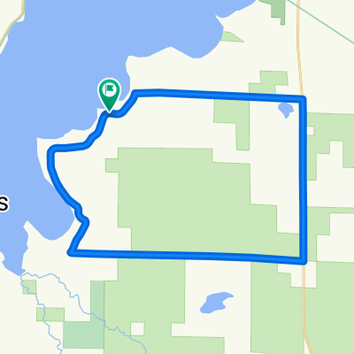
 Burt lake to Oden Island nature preserve
- Distance
- 24.9 km
- Ascent
- 125 m
- Descent
- 121 m
- Location
- Indian River, Michigan, United States
 Burt lake to Cheboygan state park
- Distance
- 42 km
- Ascent
- 137 m
- Descent
- 145 m
- Location
- Indian River, Michigan, United States
 Riggsville Rd, Pellston to 209 State St, Charlevoix
- Distance
- 66.3 km
- Ascent
- 273 m
- Descent
- 318 m
- Location
- Indian River, Michigan, United States
 Short bike tour through Ayr
- Distance
- 0.2 km
- Ascent
- 0 m
- Descent
- 0 m
- Location
- Indian River, Michigan, United States
 Devereaux - Hackleburg Loop
- Distance
- 23.9 km
- Ascent
- 139 m
- Descent
- 142 m
- Location
- Indian River, Michigan, United States
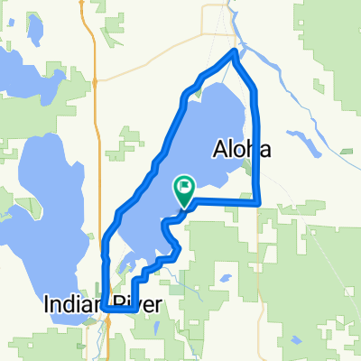 Around Mullet Lake
- Distance
- 59 km
- Ascent
- 243 m
- Descent
- 243 m
- Location
- Indian River, Michigan, United States
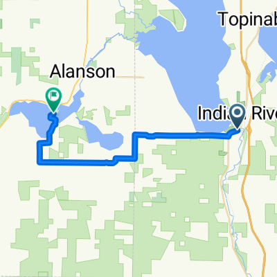
 7873–7931 US-31, Alanson to 702 S Nicolet St, Mackinaw City
- Distance
- 53.2 km
- Ascent
- 107 m
- Descent
- 108 m
- Location
- Indian River, Michigan, United States
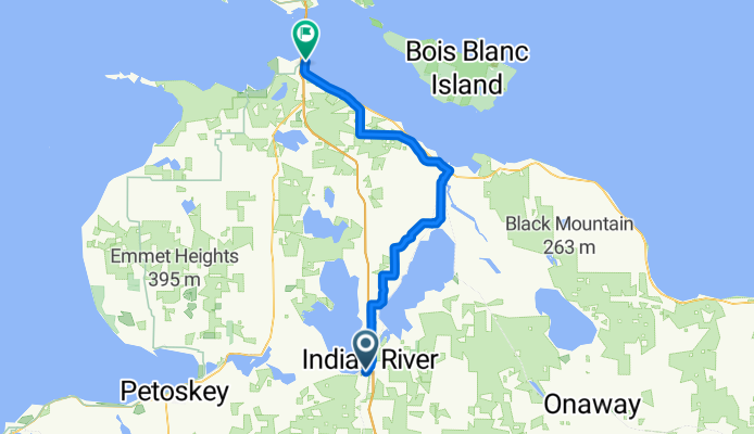
 13917 Molineaux Rd, Wolverine to Jackson Alley, Gaylord
- Distance
- 59.2 km
- Ascent
- 388 m
- Descent
- 280 m
- Location
- Indian River, Michigan, United States