
Cycling in Shelby
Discover a map of 193 cycling routes and bike trails near Shelby, created by our community.
Region portrait
Get to know Shelby
Find the right bike route for you through Shelby, where we've got 193 cycle routes to explore. Most people get on their bikes to ride here in the months of May and June.
2,892 km
Tracked distance
193
Cycle routes
74,099
Population
Community
Most active users in Shelby


From our community
The best bike routes in and around Shelby
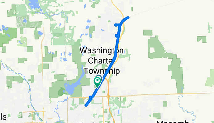
Macomb Orchard Trail, Washington to Macomb Orchard Trail, Washington
Cycling route in Shelby, Michigan, United States
- 31.2 km
- Distance
- 94 m
- Ascent
- 95 m
- Descent


Discover more routes
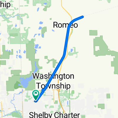 Ride 2 End Suicide
- Distance
- 31.9 km
- Ascent
- 41 m
- Descent
- 42 m
- Location
- Shelby, Michigan, United States
 5594 Stoney Pl S, Shelby Township to 13934 Forest Ridge Cir, South Lyon
- Distance
- 65.9 km
- Ascent
- 130 m
- Descent
- 73 m
- Location
- Shelby, Michigan, United States
 Stony
Stony- Distance
- 9.5 km
- Ascent
- 54 m
- Descent
- 55 m
- Location
- Shelby, Michigan, United States
 StoneyCreek MetroPark
- Distance
- 19.1 km
- Ascent
- 120 m
- Descent
- 119 m
- Location
- Shelby, Michigan, United States
 Route from 50765 Mile End Dr, Shelby Township
- Distance
- 4.2 km
- Ascent
- 15 m
- Descent
- 18 m
- Location
- Shelby, Michigan, United States
 Orchard trail
- Distance
- 70.4 km
- Ascent
- 88 m
- Descent
- 87 m
- Location
- Shelby, Michigan, United States
 57276 Yorkshire Dr, Washington to 55161 Shelby Rd, Shelby Township
- Distance
- 3.2 km
- Ascent
- 10 m
- Descent
- 22 m
- Location
- Shelby, Michigan, United States
 サイクリング
- Distance
- 70.8 km
- Ascent
- 85 m
- Descent
- 83 m
- Location
- Shelby, Michigan, United States