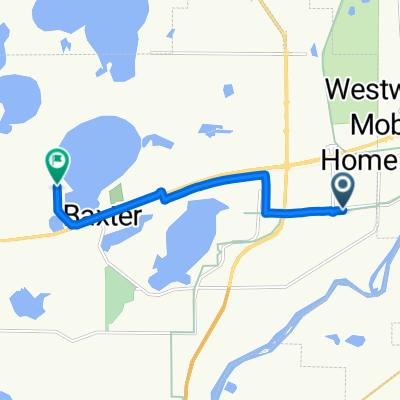
Cycling in Brainerd
Discover a map of 21 cycling routes and bike trails near Brainerd, created by our community.
Region portrait
Get to know Brainerd
Find the right bike route for you through Brainerd, where we've got 21 cycle routes to explore.
1,438 km
Tracked distance
21
Cycle routes
13,590
Population
Community
Most active users in Brainerd
From our community
The best bike routes in and around Brainerd
Brainerd loop for Sue's group of 12
Cycling route in Brainerd, Minnesota, United States of America
Meet at the Trailhead and parking lot located at the Northland Arboretum.
Ride out heading west on Paul Bunyan tail connector.Â
Take a left onto the Pual Bunyan Trail and head South, over bridge accross Excelsior Dr and through underpass, under State Highway 210.Â
Turn Right at the Trail "T" and head West. Short distance to the intersection at Cypress Drive. Follow the trail by taking a right (south) You are parrallelling the newly constructed Cypress Dr. on a newly paved trail.Â
Stay on Paved Trail, by turningleft. You are now parrellelling South College Rd. Trail easily navigates several roundabouts through this long segment. This segment ends when you cross over the Mississippi River.
Once over the river, the trail continues East, along East College Dr. to the next roundabout. You will avoid the roundabout by staying on the trail and climbing a hill past the currently under construction Brainerd High School. You are haeding Norht along South 5th St.Â
Take a right onto the paved trail on the south side of Oak Street.Â
Stay on the Oak Street paved trail untill you cross over 8th St. Then follow the trail North along 8th for 3 blocks.Â
Turn left (west) onto Laurel street for approx 2 blocks untill you arrive at Sage on Laurel (left/south side of Laurel) where you will eat lunch. Park bikes in parking lot/around the outside of outdoor seating area.Â
After lunch, head back east along Laurel to the trail at South 8th.Â
Take a left onto the trail on South 8th by heading North for approximately 2 blocks.
Cross over Washington St/Hwy 210 at crossing.Â
Once over Washington St./Hwy 210 hang an immediate left for two blocks untill you reach a trail at the intersection of Norht 10th (small park like triagle with a trail that leads to a large parking lot of Franklin Arts Center.
Continue throught the parking lot of the Franklin Arts Center accross Kingwood street where the trail picks up and is very clearly defined.Â
Continue west to 5Rocks Distillery which is located on the corwy ner of 1st Ave. NE and Washington/Hwy 210.Â
Have a drink!Â
Reverse Course and head back to the Arboretum Trailhead!
Â
Â
- 13.6 km
- Distance
- 67 m
- Ascent
- 67 m
- Descent
Lake Tour
Cycling route in Brainerd, Minnesota, United States of America
BLA summer route
(cloned from route 3102700)
- 68.7 km
- Distance
- 196 m
- Ascent
- 195 m
- Descent
Paul Bunyan Trail
Cycling route in Brainerd, Minnesota, United States of America
- 152.5 km
- Distance
- 186 m
- Ascent
- 138 m
- Descent
Brainerd Home
Cycling route in Brainerd, Minnesota, United States of America
From Little Falls you pick up the bike trail, county roads to Mississippi, and the Wobegon Trail just North of Bowlus, from there it's bike trail to Albany, Heartland Trail to Melrose, back to the Highway.
- 180.4 km
- Distance
- 169 m
- Ascent
- 138 m
- Descent
Discover more routes
- DK Mississippi 6
- Distance
- 36.8 km
- Ascent
- 100 m
- Descent
- 76 m
- Location
- Brainerd, Minnesota, United States of America
- zur Hockeyhalle
- Distance
- 30.5 km
- Ascent
- 307 m
- Descent
- 292 m
- Location
- Brainerd, Minnesota, United States of America
- Mississippi River Trail: Brainerd to Aitkin
- Distance
- 56.8 km
- Ascent
- 188 m
- Descent
- 189 m
- Location
- Brainerd, Minnesota, United States of America
- Recovered Route
- Distance
- 21.6 km
- Ascent
- 108 m
- Descent
- 101 m
- Location
- Brainerd, Minnesota, United States of America
- Spred Out Morning Ride In Brainerd
- Distance
- 33.9 km
- Ascent
- 331 m
- Descent
- 327 m
- Location
- Brainerd, Minnesota, United States of America
- GULL-QEQUOT-BREEZY-HOME
- Distance
- 95.2 km
- Ascent
- 190 m
- Descent
- 198 m
- Location
- Brainerd, Minnesota, United States of America
- 510 Laurel St, Brainerd to 301 Minnesota Ave W, Walker
- Distance
- 101.6 km
- Ascent
- 159 m
- Descent
- 122 m
- Location
- Brainerd, Minnesota, United States of America
- Brainerd Cycling
- Distance
- 64.9 km
- Ascent
- 109 m
- Descent
- 116 m
- Location
- Brainerd, Minnesota, United States of America