
Cycling in Hopkins
Discover a map of 49 cycling routes and bike trails near Hopkins, created by our community.
Region portrait
Get to know Hopkins
Find the right bike route for you through Hopkins, where we've got 49 cycle routes to explore. Most people get on their bikes to ride here in the month of June.
873 km
Tracked distance
49
Cycle routes
17,591
Population
Community
Most active users in Hopkins
From our community
The best bike routes in and around Hopkins
B2B00232 55343 55416 via SWLRT, Cedar Lake Trails
Cycling route in Hopkins, Minnesota, United States of America
This route was built to minimize interaction with traffic. A rider comfortable mixing with high volumes of motor vehicle traffic could ride North on Baker to Pymouth to Cedar Lake Road to reach this destination.Â
- 14.3 km
- Distance
- 48 m
- Ascent
- 83 m
- Descent
Unmapped Loop
Cycling route in Hopkins, Minnesota, United States of America
- 48.1 km
- Distance
- 182 m
- Ascent
- 181 m
- Descent
B2B00245 55346>55431 via Baker Rd, Anderson Lakes Pkwy, W 84th St
Cycling route in Hopkins, Minnesota, United States of America
There should be a bike path along Baker, Anderson Lakes Pkwy, Veness Rd, W Bush Lake, W 84th and American Blvd.Â
- 18.4 km
- Distance
- 137 m
- Ascent
- 163 m
- Descent
Home to Work
Cycling route in Hopkins, Minnesota, United States of America
- 15.8 km
- Distance
- 141 m
- Ascent
- 174 m
- Descent
Discover more routes
- B2B Minnetonka to QBP
- Distance
- 17.9 km
- Ascent
- 99 m
- Descent
- 131 m
- Location
- Hopkins, Minnesota, United States of America
- Minnesota River Bluffs Regional Lrt Trail, Minnetonka to 7021 Howard Ln, Eden Prairie
- Distance
- 8.3 km
- Ascent
- 74 m
- Descent
- 75 m
- Location
- Hopkins, Minnesota, United States of America
- From Work via Valley View
- Distance
- 13.5 km
- Ascent
- 84 m
- Descent
- 119 m
- Location
- Hopkins, Minnesota, United States of America
- From Work via Hillary Ln and Dewey Hill
- Distance
- 13.5 km
- Ascent
- 81 m
- Descent
- 112 m
- Location
- Hopkins, Minnesota, United States of America
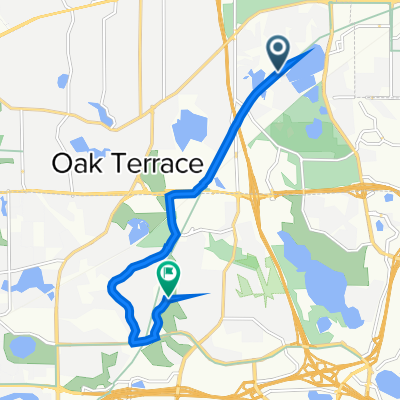
- Sanibel Drive 5464, Hopkins to State Highway No 100 South 3700, St. Louis Park
- Distance
- 10.8 km
- Ascent
- 37 m
- Descent
- 33 m
- Location
- Hopkins, Minnesota, United States of America
- crown to knox
- Distance
- 15.1 km
- Ascent
- 46 m
- Descent
- 72 m
- Location
- Hopkins, Minnesota, United States of America
- Mt Willy Loop
- Distance
- 4.8 km
- Ascent
- 56 m
- Descent
- 56 m
- Location
- Hopkins, Minnesota, United States of America
- HDMG Ride
- Distance
- 20.3 km
- Ascent
- 63 m
- Descent
- 108 m
- Location
- Hopkins, Minnesota, United States of America