
Cycling in Apalachin
Discover a map of 13 cycling routes and bike trails near Apalachin, created by our community.
Region portrait
Get to know Apalachin
Find the right bike route for you through Apalachin, where we've got 13 cycle routes to explore.
281 km
Tracked distance
13
Cycle routes
1,131
Population

From our community
The best bike routes in and around Apalachin

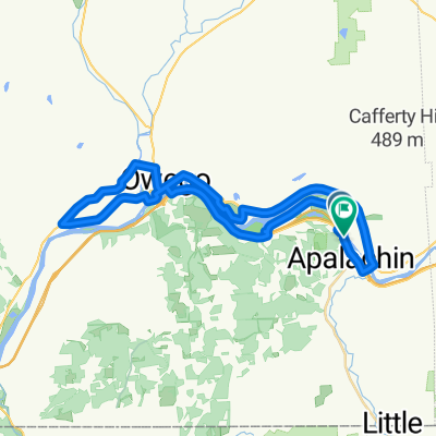
Lillie Hill to Penn Ave
Cycling route in Apalachin, New York, United States
- 16.2 km
- Distance
- 375 m
- Ascent
- 380 m
- Descent

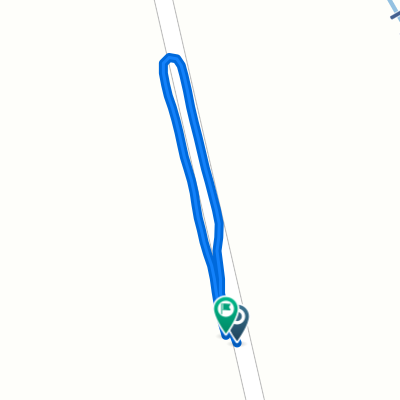
Tracy Creek Loop
Cycling route in Apalachin, New York, United States
- 22.6 km
- Distance
- 500 m
- Ascent
- 526 m
- Descent

Apalachin PA Trail
Cycling route in Apalachin, New York, United States
- 24.5 km
- Distance
- 611 m
- Ascent
- 617 m
- Descent

Apalachin Trail
Cycling route in Apalachin, New York, United States
- 12 km
- Distance
- 347 m
- Ascent
- 369 m
- Descent
Discover more routes
 538 W Main St, Apalachin to 538 W Main St, Apalachin
- Distance
- 26.5 km
- Ascent
- 131 m
- Descent
- 134 m
- Location
- Apalachin, New York, United States
 42.081, -76.160 to 42.081, -76.160
- Distance
- 42.5 km
- Ascent
- 195 m
- Descent
- 200 m
- Location
- Apalachin, New York, United States
 Midland Road to Midland Road
- Distance
- 0.5 km
- Ascent
- 40 m
- Descent
- 0 m
- Location
- Apalachin, New York, United States
 Midland Road to Midland Road
- Distance
- 9.6 km
- Ascent
- 54 m
- Descent
- 25 m
- Location
- Apalachin, New York, United States
 Aldrich Drive to Midland Road
- Distance
- 5.2 km
- Ascent
- 77 m
- Descent
- 31 m
- Location
- Apalachin, New York, United States
 NY-434, Apalachin to NY-434, Apalachin
- Distance
- 27.9 km
- Ascent
- 141 m
- Descent
- 141 m
- Location
- Apalachin, New York, United States
 NY-434, Apalachin to NY-434, Apalachin
- Distance
- 28 km
- Ascent
- 432 m
- Descent
- 248 m
- Location
- Apalachin, New York, United States
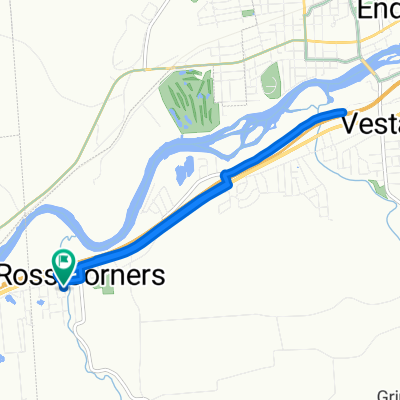
 NY-434, Apalachin to Park St, Endicott
- Distance
- 29.4 km
- Ascent
- 179 m
- Descent
- 182 m
- Location
- Apalachin, New York, United States