
Cycling in Lyndonville
Discover a map of 33 cycling routes and bike trails near Lyndonville, created by our community.
Region portrait
Get to know Lyndonville
Find the right bike route for you through Lyndonville, where we've got 33 cycle routes to explore.
754 km
Tracked distance
33
Cycle routes
1,207
Population
Community
Most active users in Lyndonville


From our community
The best bike routes in and around Lyndonville

Willoughby 50
Cycling route in Lyndonville, Vermont, United States of America
one lake
- 50.5 km
- Distance
- 371 m
- Ascent
- 371 m
- Descent

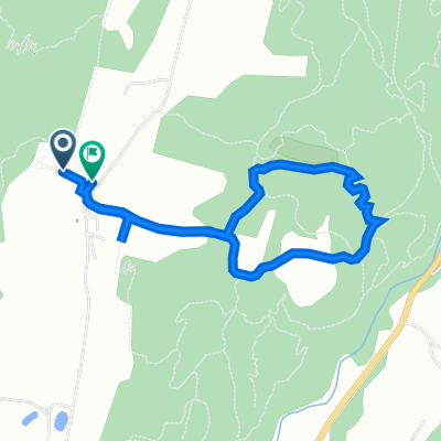
Burke to Maple Ridge AM ride
Cycling route in Lyndonville, Vermont, United States of America
Great scenic shorter ride for an AM or PM. Unpaved sections are smoother than the pavement for the most part. Fine for road bikes. Skip the little spur to the N on Maple ridge unless you want to hook into some other back roads!
- 23.6 km
- Distance
- 422 m
- Ascent
- 422 m
- Descent

Lyndonville VT -> Ste-Catherine
Cycling route in Lyndonville, Vermont, United States of America
belle chaussée tut au long, longue montée du 10e au 23e km puis descente sur 7 km par la suite. Route très tranquille.
- 128 km
- Distance
- 926 m
- Ascent
- 921 m
- Descent

Moriah’s Ascent (one way)
Cycling route in Lyndonville, Vermont, United States of America
- 1 km
- Distance
- 54 m
- Ascent
- 4 m
- Descent
Discover more routes
 1219–1399 Kirby Rd, East Burke to 39 Main St, Montpelier
- Distance
- 81.5 km
- Ascent
- 520 m
- Descent
- 744 m
- Location
- Lyndonville, Vermont, United States of America
 Route to 2261 Darling Hill Rd, Lyndonville
- Distance
- 4.1 km
- Ascent
- 110 m
- Descent
- 97 m
- Location
- Lyndonville, Vermont, United States of America
 Sugarhouse run vers herb's
- Distance
- 7 km
- Ascent
- 131 m
- Descent
- 160 m
- Location
- Lyndonville, Vermont, United States of America
 Recovered Route
- Distance
- 2.8 km
- Ascent
- 40 m
- Descent
- 81 m
- Location
- Lyndonville, Vermont, United States of America
 2052 Darling Hill Rd, East Burke to 181–191 Ch de l'Étang-Sugar-Loaf, Potton
- Distance
- 103.5 km
- Ascent
- 3,946 m
- Descent
- 3,906 m
- Location
- Lyndonville, Vermont, United States of America
 the Wildflower Inn to Potton
- Distance
- 98.6 km
- Ascent
- 1,519 m
- Descent
- 1,507 m
- Location
- Lyndonville, Vermont, United States of America
 Parrs yard vers Herb's
- Distance
- 14.3 km
- Ascent
- 176 m
- Descent
- 425 m
- Location
- Lyndonville, Vermont, United States of America
 northeast kingdom challenge
- Distance
- 93.3 km
- Ascent
- 522 m
- Descent
- 516 m
- Location
- Lyndonville, Vermont, United States of America