
Cycling in King
Discover a map of 12 cycling routes and bike trails near King, created by our community.
Region portrait
Get to know King
Find the right bike route for you through King, where we've got 12 cycle routes to explore.
136 km
Tracked distance
12
Cycle routes
1,750
Population
Community
Most active users in King


From our community
The best bike routes in and around King


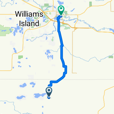
Pleasant Park Lane N2654, Waupaca to Wisconsin 152 N3711, Wautoma
Cycling route in King, Wisconsin, United States
- 32 km
- Distance
- 303 m
- Ascent
- 313 m
- Descent

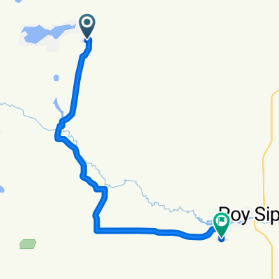
Cobbtown Cruise - 6 miles!
Cycling route in King, Wisconsin, United States
- 9.4 km
- Distance
- 76 m
- Ascent
- 75 m
- Descent

West Windfelt Lane, Waupaca to West Windfelt Lane, Waupaca
Cycling route in King, Wisconsin, United States
- 5.7 km
- Distance
- 62 m
- Ascent
- 28 m
- Descent
Discover more routes
 East Road N421, Waupaca to East Road N421, Waupaca
- Distance
- 2.7 km
- Ascent
- 14 m
- Descent
- 14 m
- Location
- King, Wisconsin, United States
 E1713 Pine Ridge Ln, Waupaca to E1714 Pine Ridge Ln, Waupaca
- Distance
- 5.2 km
- Ascent
- 7 m
- Descent
- 13 m
- Location
- King, Wisconsin, United States
 Waupaca to Waupaca
- Distance
- 6.1 km
- Ascent
- 3 m
- Descent
- 7 m
- Location
- King, Wisconsin, United States
 hartman 4-23-23
- Distance
- 10.1 km
- Ascent
- 588 m
- Descent
- 616 m
- Location
- King, Wisconsin, United States
 N2480 Hartman Creek Rd, Waupaca to N2480 Hartman Creek Rd, Waupaca
- Distance
- 9.7 km
- Ascent
- 148 m
- Descent
- 145 m
- Location
- King, Wisconsin, United States
 N2487–N2491 Hartman Creek Rd, Waupaca to Waupaca
- Distance
- 9.1 km
- Ascent
- 134 m
- Descent
- 137 m
- Location
- King, Wisconsin, United States
 County Road TT W4364 to Churchill Street
- Distance
- 19.5 km
- Ascent
- 84 m
- Descent
- 88 m
- Location
- King, Wisconsin, United States
 County Road TT W4364 to 30th Drive N4070
- Distance
- 18.5 km
- Ascent
- 116 m
- Descent
- 116 m
- Location
- King, Wisconsin, United States