
Cycling in East Sahuarita
Discover a map of 5 cycling routes and bike trails near East Sahuarita, created by our community.
Be a pioneer
Inspire fellow cyclists with your route in East Sahuarita
Bikemap is a global cycling community with millions of routes created by cyclists like you. There are only a few routes so far in East Sahuarita, so plot your favourite rides on the map now to help others find the best ways to ride.
From our community
The best bike routes in and around East Sahuarita
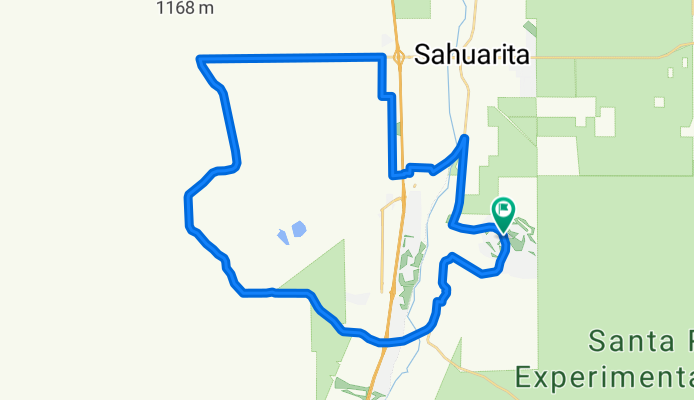
QuailCreek-HelmetPeak-BackRoads
Cycling route in East Sahuarita, Arizona, United States of America
This route uses some back roads after Helmet Peak. After Santo Tomas you actually get on a cement paved path to go under I-19 to come out near Walmart.
- 51.2 km
- Distance
- 323 m
- Ascent
- 323 m
- Descent
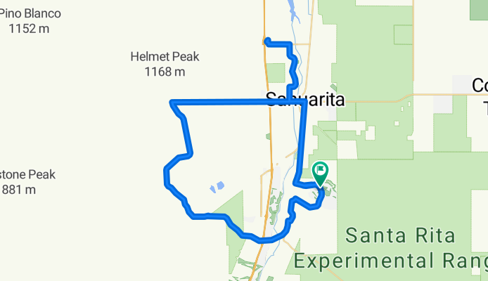
QuailCreek-HelmetPeak-Casino
Cycling route in East Sahuarita, Arizona, United States of America
Food stop at the casino on Pima Mine Rd.
- 66 km
- Distance
- 349 m
- Ascent
- 349 m
- Descent
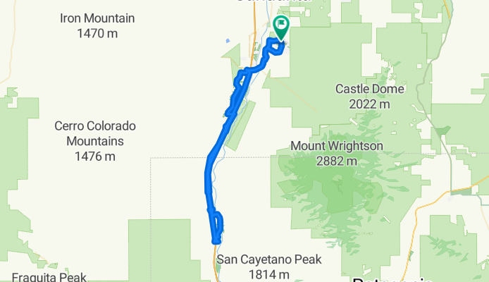
QuailCreek-Tubac-return
Cycling route in East Sahuarita, Arizona, United States of America
You have to get on the highway at Agua Linda for one exit, the frontage road does not go thru. Not as bad as it seems. Same thing happens on the return. Get on at Chavez Crossing.
Food at Tubac.
Altimeter says 1720 ft of climbing.
As flat as it gets.
- 84.6 km
- Distance
- 178 m
- Ascent
- 178 m
- Descent
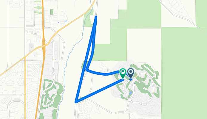
1418–1482 N Quail View Loop, Sahuarita to 1908 E Cliff Swallow Trail, Sahuarita
Cycling route in East Sahuarita, Arizona, United States of America
- 9 km
- Distance
- 32 m
- Ascent
- 38 m
- Descent